The Michael Mary Line Part 4: White Horses and Dragons

A few years ago, we journeyed along the Michael/Mary line beginning in Ogbourne St George, Wiltshire, and headed west to Dartmoor. Sometime later, we returned to the Wessex Downs but this time coming in from the opposite direction (Caln, in the west). As soon as we entered the chalk scarp, we were struck by the huge telluric, geological currents surging through the porous rock, pushing up gentle hillocks and forming combes that looked like nodes in the land. Green fuzz now covers the chalk, which is therefore no longer visible – unless a white horse has been carved in it, that is.

Alton Barnes White Horse (credit Wikipedia)

White horses and hill forts abound in these vales demonstrating how important they once were to the people who loved and lived in them. The White Horse of Alton Barnes gracing the side of Milk Hill is visible from the A4, itself looking out towards the famous White Horse of Pewsey, where a new white horse replaces an older and now faded older version. A gentle walk along the top of the Wansdyke brings the relief of the land into clear focus, and places the white horses firmly in the context of the a broader landscape that undulates across to the Mendips and Cotswolds far into the distance. The Wansdyke itself is an intriguing feature and was probably built by the ancient Britons to keep the Saxon invaders out in a time of invasion and flux.

We continued north passed Windmill Hill and joined up with the Ridgeway. Part of a massive chalk escarpment some four hundred miles long and extending from Dorset to East Anglia, the section between the Sanctuary and the Ivinghoe Beacon in Berkshire is the most famous uninterrupted national walking trail in the country. It is along this pathway that the great dragon energies emerge from the chalk as telluric currents and intermingle with the more precise energies of the Michael/Mary line that we had been dowsing since Dartmoor. Iron Age hill forts, often built over more ancient Neolithic causewayed enclosures, become a stronger feature of the landscape, holding these powerful energies in a way that churches are unable to.

Barbary Castle (credit Wikipedia)

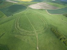
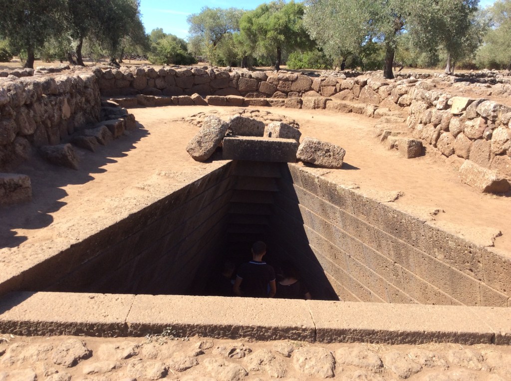
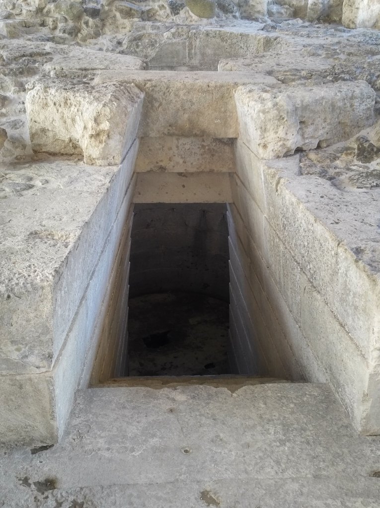
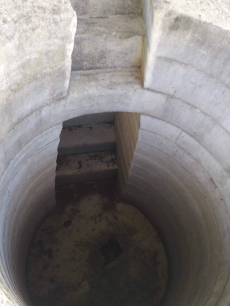
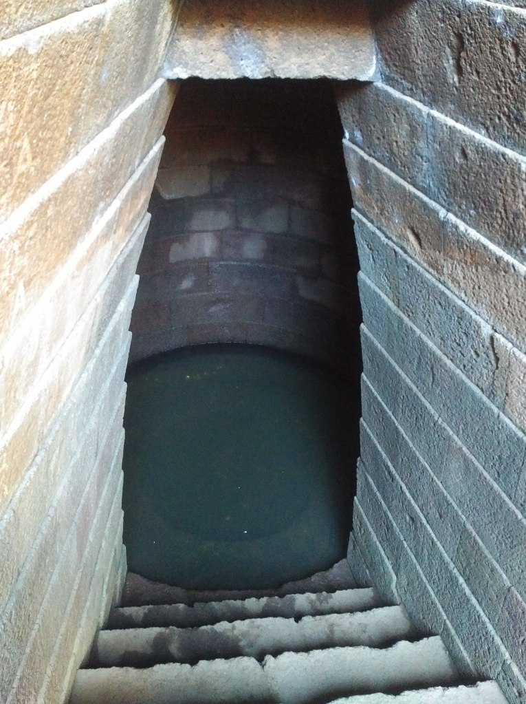
It was exciting and exhilarating to feel the energies swirling through Barbary castle with its three rings and ditch enclosures. Circling and dancing like a coiled snake, the earthworks contained and amplified the energies in an honouring and respectful way. This joyful dance continued along the Ridgeway to Liddington Camp, one of the earliest of the hill forts and dating back to the Late Bronze Age (around 700 BCE). These ‘forts’ were primarily used as places were clans met and feasted, traded goods and worshipped, though some defensive function is also not excluded. Therefore the term ‘fort’ does not do them justice, and neither does the medieval word ‘castle’ that implies a form of conquer and control that was not present in the minds of the people who created these structures.

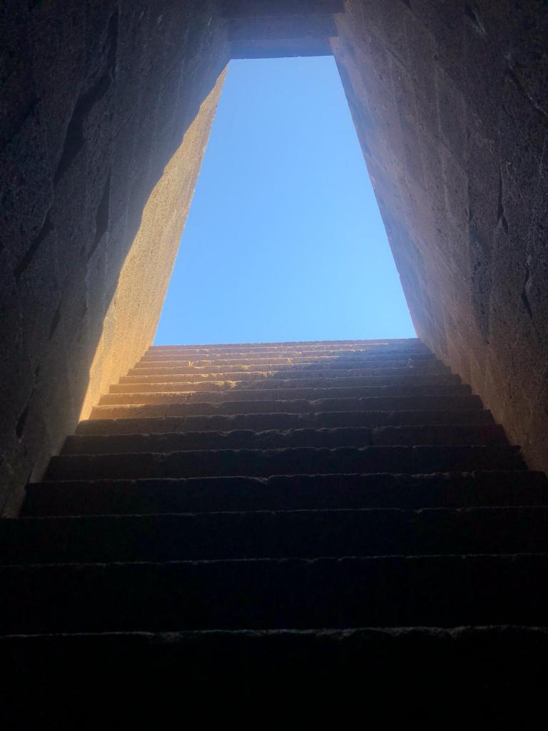
In the centre of the Liddington earthworks, the energy was particularly intense and demanded some form of acknowledgement. Later, further research revealed the existence of a ritual shaft, used by the ancient Britons who occupied this site to ritually connect more deeply with the land, and harness the protective and abundant energies in a mutually honouring way.

Vale of the White Horse (credit author)

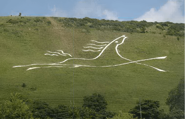
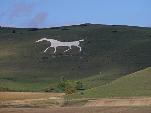
The Ridgeway continues northeast, and is cut across brutally by the M4 motorway, contrasting strongly with the respectful energies we had felt previously. Now we were in Oxfordshire but the underlying chalk knew no such boundaries and the great dragon currents surged towards the most famous vale of all – the Vale of the White Horse. According to Miller and Broadhurst, [1]the Mary current sweeps round the nexus point containing some of the most important sites in the country – The White Horse, Ufffington Castle, Dragon Hill and Wayland’s Smithy – and is anchored at the church of St Mary in Uffington. It is also just north of this area that the Belinus line crosses over the Michael/Mary line, forming a major omphalos (more on this to come). We went into this centre to explore the energies in more detail.

Wayland’s Smithy (credit author)

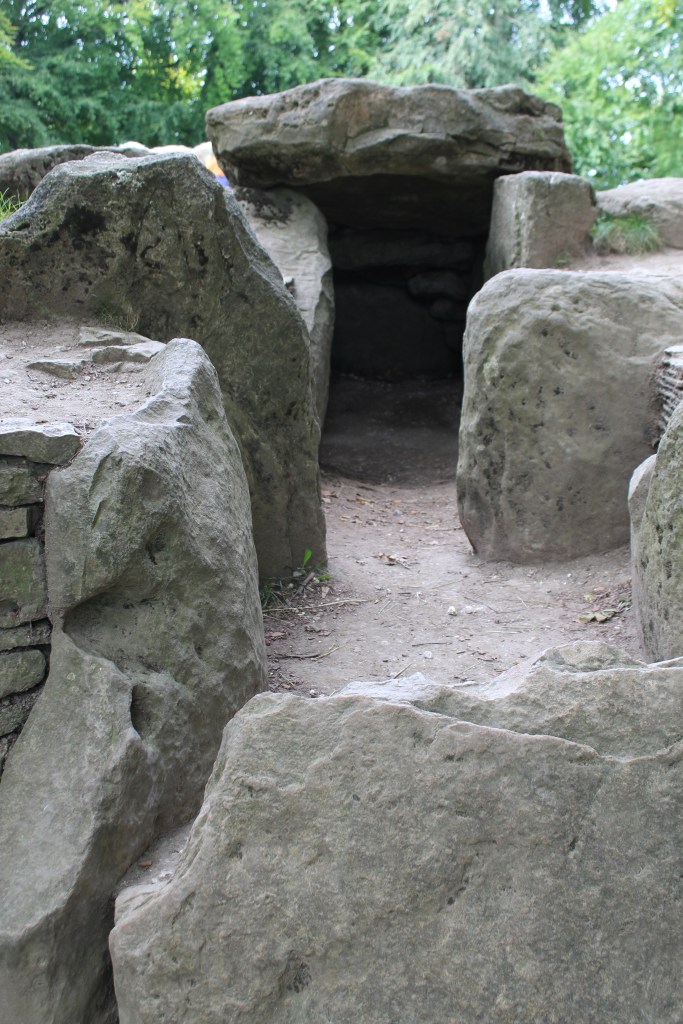
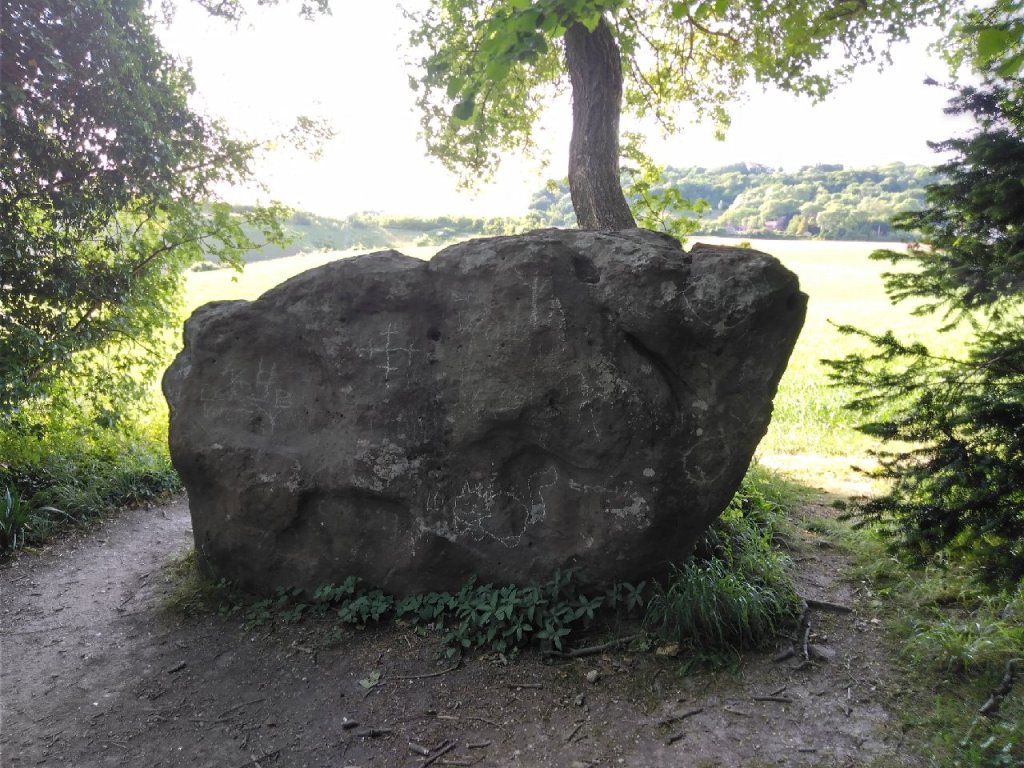
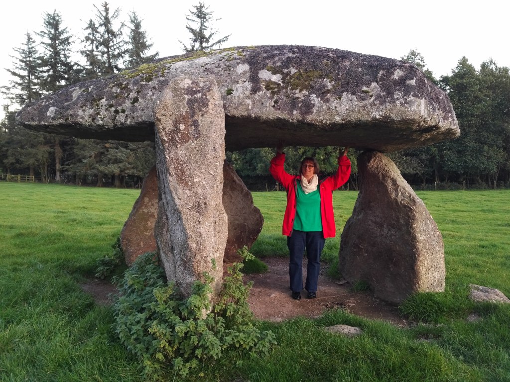
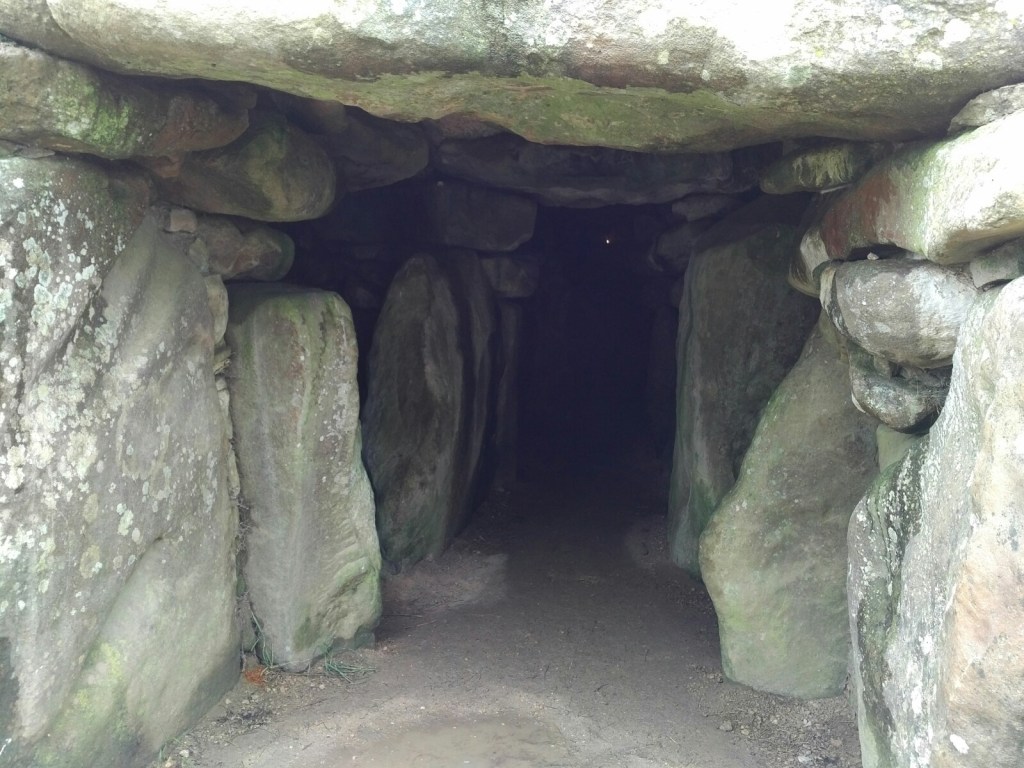
Just beneath Fox Hill, the Ridgeway now passes through one of the earliest Neolithic long barrows in Britain – Wayland’s Smithy. Set in a secluded grove ringed by trees, a stone burial chambers covered by a huge earth mound are surrounded by an enclosure of sarsen stones. Built during the Neolithic by the mysterious early agriculturalists in two stages, an earlier timber barrow could date back as early as 3590 BC.[2]

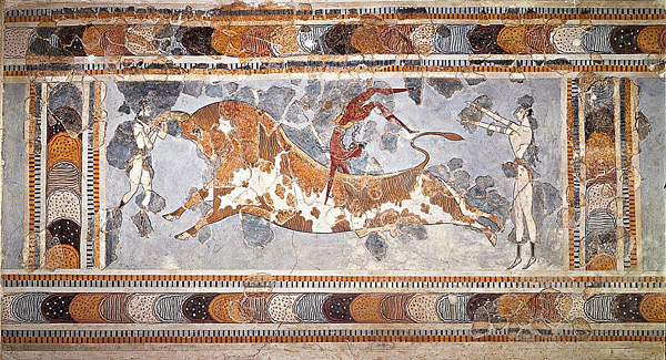
 The Saxons were probably the first to link the Germanic smith-god Wayland with this site, a rather ambivalent mythological figure who emerges, often in an unfavourable light, in a range of contexts from the Icelandic Eddas to the exquisitely carved Frank’s Casket, where he is depicted holding a severed head with the aid of tongs in one hand and a goblet in the other. Though the myth has him slaying a king’s son and cutting off his head, plying the same king’s daughter with wine and raping her, he is also associated with making wings from birds feathers that enable him to fly. This could account for why he appears in a variety of places plying his trade of smith, possibly linking this site (mythically at the least) with an early phase of metallurgy in pre-history. In more favourable contexts, Wayland is associated with forging magical swords and also the mail shirt worn by Beowolf in the epic poem of the same name. [3]

White Horse of Uffington (credit Wikipedia)

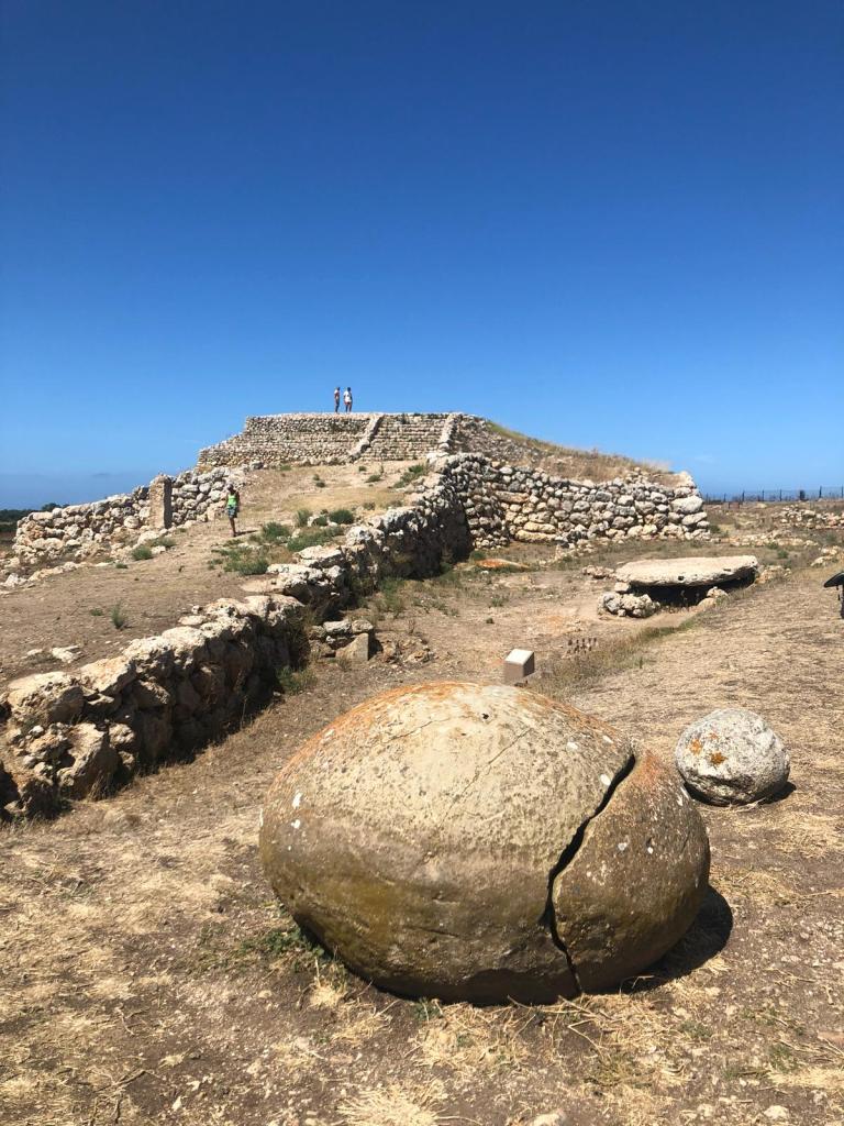
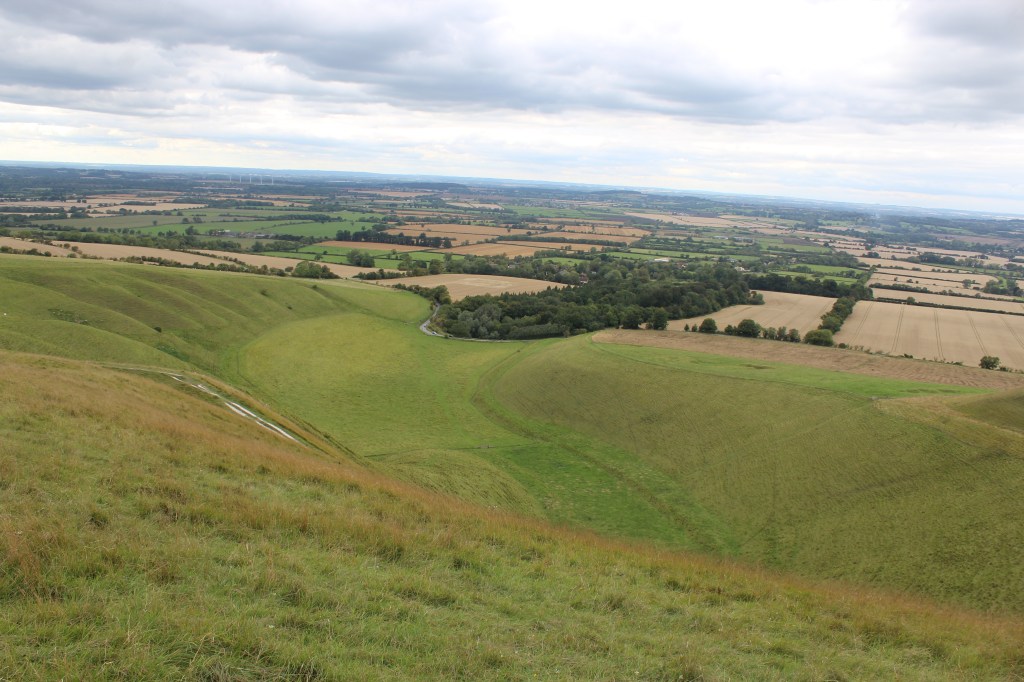
The White Horse itself is situated on the upper slopes of White Horse Hill, a distinctive undulating steep-sided valley formed by the interplay of land with the repeated freeze-thaw cycles of the last Ice Age. It can only really be appreciated from above or at a distance to see its full extent, emphasising its role as a beacon or orientation point in a sacred landscape. The White Horse itself has been dated to the late Bronze Age (1380 – 550 BC)  as has the (once again misnamed) Uffington castle on top of the hill, a huge square structure surrounded by earthworks. Not much of the original remains but to walk the parameters of the site gives some feel of its scope and scale. As the highest place for miles around, it would have had great ritual (and therefore economic) importance for the ancient Britons who inhabited the area.  

The energies are still palpable in the earthworks but do not have the joyful innocent quality that we had felt previously. These ancient walkways were fed by pilgrims and travellers that kept the energy flowing between nodal points, often represented by barrows and mounds, through a mutual honouring between land and walker. When this is no present, the flow and therefore the energies recede into the background, or indeed stagnate, waiting patiently to be acknowledged and activated once again at some future time.

Dragon Hill (credit author)

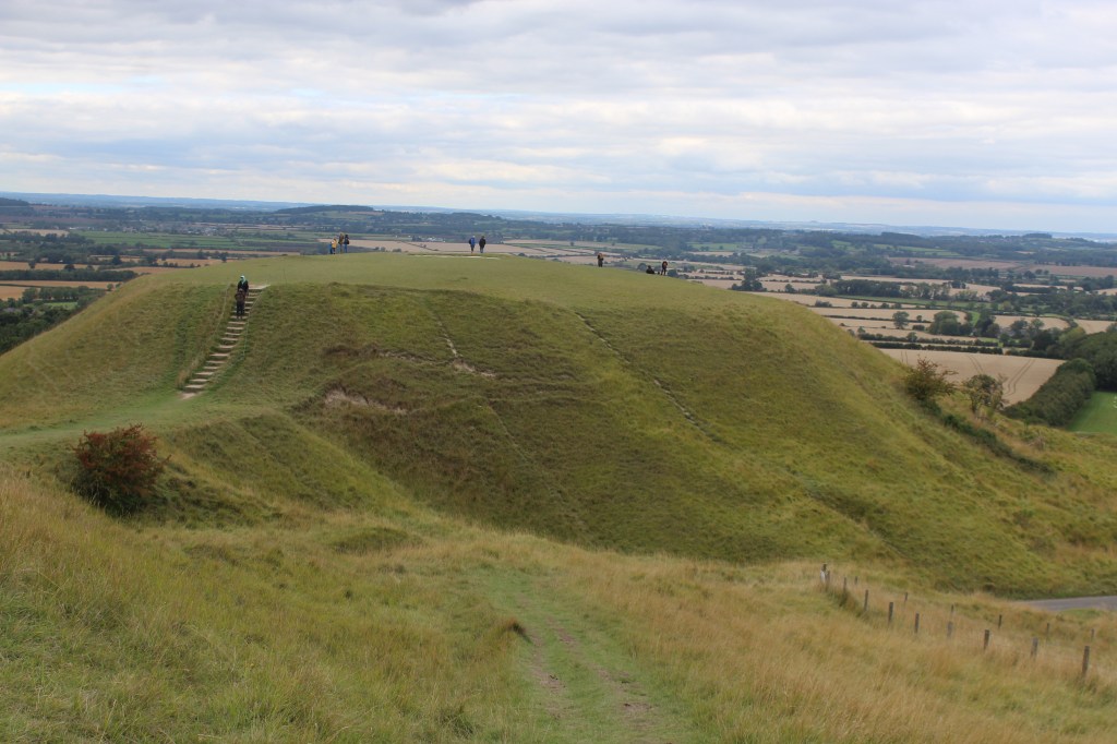
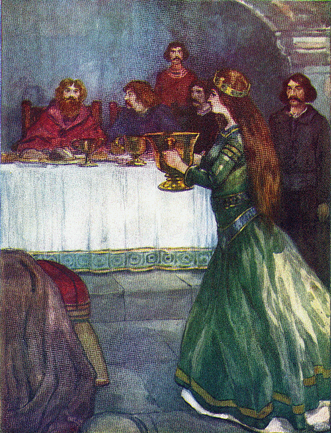
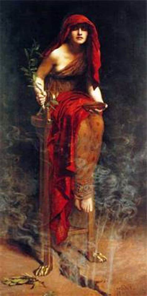
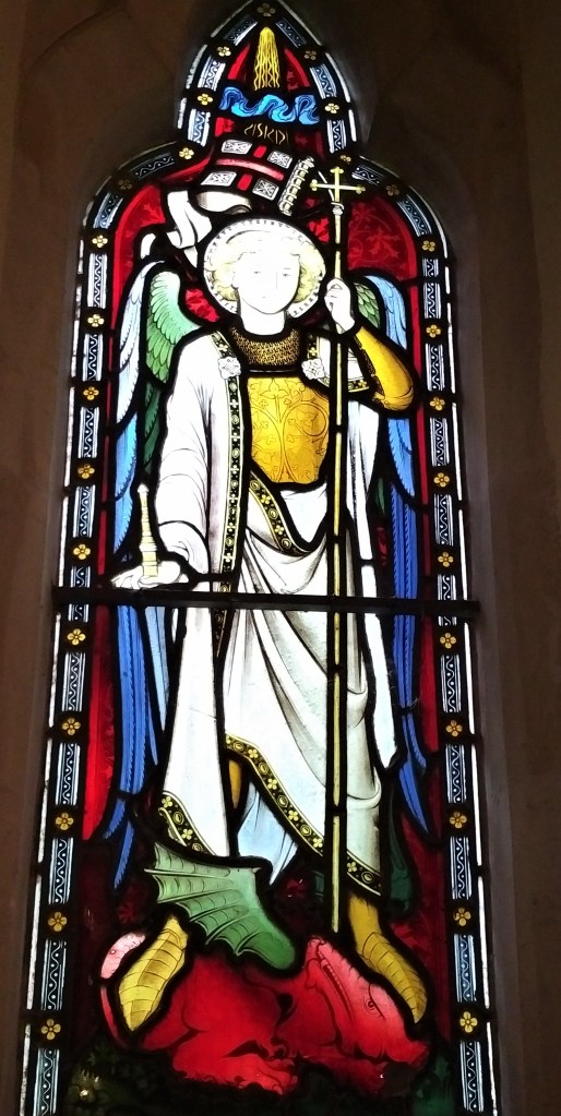
The White Horse itself is no longer accessible and when standing in the physical landscape, it is hard to see the horse at all. Indeed, it is now Dragon Hill, a small chalk hill with artificially flattened top siting sitting just below the White Horse, that draws the visitor in both visually and energetically. A large chalk circle marks the eye, said to be the spot where St George killed the dragon, the blood preventing grass from growing on its summit. As ever the myth of dragon slaying going hand in hand with the presence of huge telluric landscape currents, which is one of the reasons that these energies are called dragon energies.

It is significant that both the dragon and horse are present in this landscape. There are many theories as to the meaning of the White Horse. Some see it as a solar horse, whose origins stretch back into the deep past of an Indo-European mythology that perceived the sun carried across the sky by a horse or chariot. [4] Archaeo-astronomical investigations have suggested a link between the horse and the midwinter sun, others discern a connection between the landscape and the constellation of Draco, all of which warrants further investigation.

‘Rhiannon’ by Alan Lee

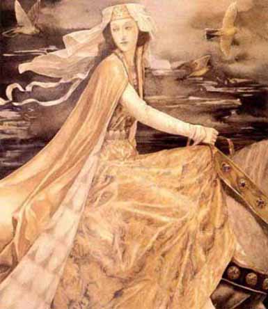
There are other land based alternatives. To the Celtic and the ancient Britons,  the white horse was the ultimate symbol of Sovereignty, who was both the goddess of the land and the land itself. She bestowed kingship in exchange for protection and when this was honoured, the land was fertile and all life forms were happy. The Brythonic Sovereignty goddesses Rhiannon is closely associated with the white horse, as are the Celtic goddesses Aine and Maeve.

White Horse (credit author)

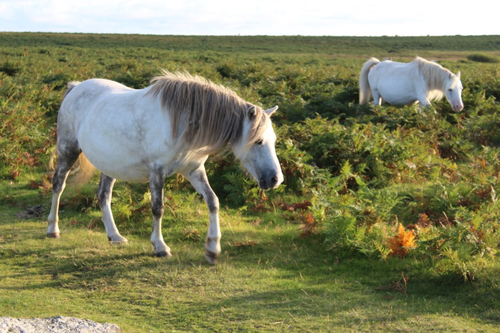
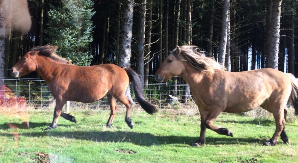
At this place of great power, we can stand and reconnect with this aspect of the land, take back our own Sovereignty and empowerment and come back into harmony with the energies of the Earth herself, and therefore with the energies of the wider cosmos. That the horse still holds energetic sway here is reflected by the land in the numerous horse racing stables that cluster at the foot of Lambourne Down, serving as training grounds for hundreds of race horses that still gallop through the Vale to this day.


[1] Broadhurst and Miller, (1998) ‘The Sun and the Serpent’

[2] ‘Wayland’s Smithy’ available at http://www.en.m.wikipedia.org

[3] As above

[4] Pollard, J. (2017). ‘The Uffington White Horse geoglyph as sun-horse.’ Antiquity. 91. (326): 406 – 420 (Accessed 10.4.21)

The Medway Megaliths Part 1: The enigma of the White Horse Stone

The White Horse Stone is shrouded in legend. It is located in the Neolithic funerary complex that we today call the Medway Megaliths, and was once possibly part of a chambered long barrow of which no other traces remain. Until recently it was one of a pair of megaliths that stood close to the Pilgrims Way in North Kent, the chalk ridge that comprises the northern limb of the Wealden anticline, but the Lower White Horse Stone was destroyed in the nineteenth century, leaving the upper White Horse Stone alone and isolated. To add insult to injury, now it can only be reached via a slip road behind a petrol station, cut off by the racing traffic of the A229 dual carriageway that links the M20 with the M2, part of the extensive motorway network that divides Kent. And just below it the Eurostar train emerges from a tunnel cut into the chalk as it speeds down towards Folkestone and the Channel Tunnel.

White Horse Stone, author’s photo

Isolated and lonely it might be, yet dating back to around 4000 BC, it is an important piece of our heritage, placed at the very beginning of the arrival of the farmers from Europe who brought with them the knowledge of agriculture.  These people were said to be semi-nomadic, yet near the stone was found the remains of an early Neolithic longhouse that was used 3780 – 3530 BC and was most likely a domestic residence. Another chambered long barrow was found nearby containing human remains and could have shed more light on these apparent contradictions, but sadly this has also been destroyed.

If the Neolithic ancestry of the stone has many unsolved elements, the legends become more complex when linked to a more recent invasion, this one involving the arrival of the Anglo-Saxon people, again from continental Europe. Around 409 AD, the last of the Romans withdrew from Britain, leaving a vacuum soon to be filled by tribes from Germany, including the Angles, Saxons, and Jutes, some of whom had already begun to settle during Roman times. The takeover was gradual and not uniform throughout the country; it could have begun in Kent, certainly the legend describing the foundation event say it was.

White Horse Stone from side, author’s photo

There are different sources for the story, and each tell a slightly different version, but the gist is as follows. Vortigern, King of the Britons, needed assistance to fight the Scottish Picts who frequently launched raiding parties into his territory. He invited the Angles to come to his aid, and in due course (449 AD),  the brothers Horsa and Hengist arrived at Ebbsfleet to serve as mercenaries. They were said to have arrived under the banner of a ‘rampant white horse.’ [1] In return for their services, they were given supplies and land on the Isle of Thanet, and in time they sent back home for more aid, causing more Angles, Saxons and Jutes to arrive in large numbers. According to Nennius in the ‘History of the Britons,’  Vortigern had bitten off more than he could chew and tried to get rid of them, but to no avail. At any rate, Hengist’s daughter Rowena came over and Vortigern fell in love with her and asked for her hand in marriage. In return, Hengist asked for Kent, which Vortigern granted even though it wasn’t strictly his to give. This made Vortigern unpopular, and he was forced into hiding by his own people. His son Vortimer turned against Hengist and Horsa, engaging them in battle and driving them back, back dying himself in the process.[2]

The Wooing of Rowena, by A. S. Forrest – Our Island Story, Public Domain

Eventually, Hengist and Horsa, now reasonably established, sent Vortigern a message of peace, and invited him to a feast where the Saxons and Britons could meet. Here a great act of treachery took place, deepening the drama of the story. Hengist’s men concealed knives ‘beneath their feet’ and murdered the unsuspecting Britons in what is known as the Treachery of the Long Knives, though they did spare Vortigern. [3]

According to the Anglo-Saxon chronicles, in 455 AD, Vortigern faced the brothers at Aylesford in Kent, where a decisive battle was fought. [4]The Saxons were victorious though Horsa was killed. Hengist went on to found the kingdom of Kent with his son, marking the beginning of Saxon rule. Horsa, according to legend, was buried by the White Horse Stone, over which was draped his banner.

In old English, Hengist and Horsa mean ‘stallion’ and ‘horse’ respectively, and Bede in his version of the story charts their geneology back to Woden, the great Norse god.[5] Both the Norse and Anglo-Saxon languages are Indo-European in origin, and have inherited aspects of Indo-European mythology, cleaving it to fit their own time and place. Two of the central tenants of this proto-mythology were founding brothers, or divine twins, and they were often associated with the horse, the most sacred animal in Indo-European cosmology. There are many examples of divine twins who founded nations, including Romulus and Remus in Rome, Aggi and Ebbi of the Danes, and Ibur and Aion of the Lombards .[6] And in all of the legends, one of the founding twins must die, as does Horsa in this case.

Folkestone White Horse

There is no evidence of course that he was actually buried beneath White Horse Stone, but the association stills lingers on. His emblem was adopted by the Jutish kingdom of Kent, the first of the Anglo-Saxon kingdoms, and the rampant white horse is still today the emblem of Kent. In this way the story of Horsa, Hengist and Vortigern can be seen as an Anglo-Saxon foundation myth, similar to Romulus and Remus in the foundation of Rome. Not to be taken literally, but seen as a sacred and part of a greater cosmology. What Horsa and Hengist as German immigrants would have made of Brexit we do not know, but the constant presence of the Eurostar train beneath the stone is certainly a reminder of our deeply European connections, and one which they appear to stand guard over today.


[1] Richard Verstegan ‘Restitution of Decayed Antiquities.’

[2] Nennius,’Historia Britonum’

[3] Nennius, Historia Britonum

[4] The Anglo Saxon Chronicles

[5] Bede ‘Ecclesiastical History of the English Nation’

[6] ‘Hengist and Horsa,’ Wikipedia (accessed 30.5.2020)

Oracles and Dragon Energies

Prophecy is one of the most ancient of all the human art forms, yet probably one of the most misunderstood. Today it is largely relegated to astrology columns in newspapers, or maybe the occasional tarot card reading, and certainly peripheral to most peoples’ daily lives. Throughout the ancient world, however, it was mainstream, the grease that oiled the cogs of state and gave succour to many a great statesman. Indeed, the oracles could be considered as the ancient equivalent to Google, the place where everyone went to find knowledge, to exchange ideas and to generally hook up with other like-minded people. But what powered the sites themselves? What enabled one site to be used as an oracle when another could not?

Tholos at Delphi (Wiki Commons)

Though oracular prophecy predates the ancient Greeks and Romans, it was their temples and myths that preserved the ancient oracular sites, and some of the mystery surrounding them. Apollo was the Greek god of prophecy and the most famous oracles were presided over by him. But this hadn’t always been the case. In archaic times, the oracles were dedicated to Earth goddesses, and presided over by priestesses who had access to the voice of the Earth, usually operating out of groves or simple sanctuaries. The myths tell us that before Apollo could take them over, he had to subdue the serpent Python, which he pursued to Mount Parnassus, then into the shrine at Delphi itself, ‘where he dispatched it beside the sacred chasm.’ As Graves suggests, this mythic takeover of Delphi probably records the historic invasion of the Northern Hellenes of pre-Hellenic cultures. As part of the takeover process, they killed the sacred oracular serpent that was kept in the sanctuary of the Earth goddess.[1]

‘Lilith’ by John Collier

Snakes are one of the most primal symbols of Earth energies. They live close to the ground, sense vibrations, and move in a sinuous wave akin to the way in which energy moves. Though the Earth energies are not visible, anyone looking at the waves on the sea could easy make the link between waves, and the way they embody form and movement, long before modern science mapped them. They can also survive beneath the ground for long periods, only to emerge in unpredictable and terrible ways, like the restless forces from within the Earth. Indeed though Apollo is said to have killed the Python, he retained the services of the oracular priestess who were themselves called ‘Pythia’ and it is highly likely that snakes were kept in the sacred tholos at Delphi well into Hellenistic times.

The Python that Apollo subdued was also known as a Dragon, and it was this Dragon that was said to have chased Apollo’s mother Leto around the Earth as she tried to give birth to him. This was clearly no ordinary snake, but one of mythic proportions, and I couldn’t help wondering if this was a metaphor for the seismic energies of the Earth itself, which Apollo must subdue if he was to use them. This was an issue I had been pondering for a while, and the opportunity to find out more presented itself on a recent trip to western Turkey.

Travertine, Pamukkale (author’s photo)

Hierapolis is not a name that is familiar to most people, but everyone has heard of Pamukkale. Though remote, more than 140 km from Izmir, over two million people visit this site every year and enjoy the thrills of dipping in the blue mineral waters that cascade over the calcareous deposit known as travertine. But not many people are aware that there was also an ancient oracle at this site, known throughout the ancient world as the Gateway to Hell. As I was to discover, this is no coincidence, for the same geological features that gives rise to the amazing mineralogy and healing waters of Pamukkale also powered this mysterious and most primal of oracles.

Mineral waters of the Travertine (author’s photo)

Turkey has frequent earthquakes because the Anatolian plate on which it sits is squeezed between the mighty African and Eurasian plates that are moving in opposite directions. Pamukkale is not situated on a plate boundary, but near a meeting point of four Graben, areas of multiple faulting and rifting caused by these plate movements. At Pamukkale, the crust has thinned as a result of the tortuous stretching of the Anatolian plate so much that it has fractured, resulting in a network of faults and fissures. Hot water from the mantle percolates through the crust, bringing with it the minerals dissolved from the local limestones, and deposits these on the surface in the form of the milky white travertine that visitors come from far and wide to see. In addition, a cocktail of noxious gases are discharged as the hot mineral rich fluids reach the surface and today, close by to the translucent blue pools in which these visitors dip, taps are visible that vent discharging gases such as carbon dioxide and sulphur dioxide, make the place safe to visit.

Remains of the Plutonium, Hierapolis (author’s photo)

In ancient times, this ancient chasm in the land, as well as its noxious gases and beautiful minerals, would have been sacred to our ancestors and a cult site was located since time immemorial dedicated to Cybele, the ancient Anatolian mother goddess and her priests, the castrated Galli, would have officiated. With the arrival of the Hellenes and then the Romans, this mysterious site where Earth processes could be seen and smelt became associated with an entrance to the Underworld, but still considered sacred as the name Hierapolis (or sacred city) implies. A temple dedicated to Pluto and his consort Kore, the equivalent of Persephone and Hades in Greek myth, was built over the sacred chasm and appropriately named the Plutonium. Guarding the entrance to the Underworld was Cerberus the three headed dog and a snake, still retaining its status as a prime Earth energy symbol. A nearby temple of Apollo took over the oracular function in the form of Apollo Lairbenus, whose mother Leto was equated with the ancient earth goddess Cybele.

Temple of Apollo (author’s photo)

Accounts from Strabo of how priests would go into an underground chamber with a deep cleft in the rock, through which flowed a fast running stream, and come out to utter prophecy suggest that they used the noxious gases as a sort of trance inducer. It is possible also that small animals were used to indicate levels of the gases, much as canaries were later used underground to warn miners. [2]

Priestess of Delphi, John Collier (1891)

The chasm at Hierapolis is reminiscent of the description of the sacred chasm at Delphi in the myth of Apollo and Python, and indeed Mount Parnassus is located in a seismically active part of Greece. Modern research has shown that the site was built over a volcano related fissure that discharged gases through the springs percolating through the rocks, either in the form of ethylene or methane. [3]The Pythia would have sat on a tripod over this chasm and uttered her prophecy in an altered state of consciousness, literally induced by the Earth energies. Interestingly this was exactly how John Collier depicted her in his iconic painting of 1891.

The connection between seismic activity and oracular sites was beginning to look far from coincidental. It was apparent that ancient people noticed the connection between springs, gases and earthquakes and deemed the chasms associated with them to be highly sacred, as well as mysterious. They placed sanctuaries and later temples on these gateways to the Underworld, where the voice of the Earth itself could be heard, and it was the dragon or serpent that came to symbolise this seismic activity.

I knew there were two more famous oracles on the Turkish Aegean coast, at Didyma and Claros, and it was there I journeyed next to further investigate the link between dragon energies and oracles.


[1] ‘The Greek Myths’ by Robert Graves, Penguin 1992

[2] ‘Blue Guide Aegean Turkey: from Troy to Bodrum,’ by Paola Pugsley, 2018

[3] See https://www.nationalgeographic.com/science/2001/08/greece-delphi-oracle-gas-vapors-science/

Dartmoor: Connecting the Mary Line (Part II)

Dartmoor Ponies (photo credit, Julie Yarrow)

Autumn was just beginning to draw its golden curtain across Dartmoor and a few trees had already begun to shed their leaves. We spent a wonderful morning exploring the tiny back lanes of the Moor, finding wells and stone circles, the places where great rivers rose and merged, and watching as ponies were rounded up for their yearly count. Then we brought out attention back to the Mary and Michael currents, which cross across the northern part of Dartmoor quite close to our accommodation at Shilstone Farm.

Nine Maidens Stone Circle, Dartmoor (author’s photo)

First stop was the evocatively named Belstone, resonating with the fire god Bel, also known as Baal in the Middle East. It was this enigmatic god, mentioned in the bible as the arch-enemy of Yahweh, who became intimately connected with the fire ceremony of Beltane throughout the ancient world. After a brisk walk across the Moor we ended up at the Nine Maidens stone circle just beneath the Belstone Tor, with beautiful vistas over the river Teyn. Behind us was a tall pole, and upon consulting the map, we noticed that we were on the edge of an army shooting range. A so-called danger zone, a black area. We could sense the Michael current coming through the stone circle, but it felt slightly out of balance. We consulted our ‘bible,’ The Sun and the Serpent,’ to find out what was going on.

According to Miller and Broadhurst,[1] the Michael current enters Dartmoor at Brentnor, crossing through Lydford and the Yes Tor, before sweeping through the Tor at Belstone and then Nine Maidens stone circle. This we could clearly discern, but it was the Mary current that was more mysterious, for there seemed to be a break in the line. Intriguingly, Miller and Broadhurst had dowsed the Mary current to Mary Tavy to the west of Dartmoor, but the part of the Moor where we now found ourselves was apparently un-chartered territory. Rising to the challenge we stepped into the centre of the Nine Maidens stone circle and tuned into the energies.

Ladywell at Sticklepath (author’s photo)

Intuitively we felt that the Mary current also crossed over the stone circle so we drew it up from Mary Tavy, across the Moor, and allowed it to dance with the Michael current that was pulsing, albeit it weakly, through this area. The energies started to merge and form a nodal point in the middle of the circle, and we could sense the imprint of an energetic connection that had almost become lost. Miller and Broadhurst had discerned a dark energy at Lydford castle, where the Michael line passes through before coming here, which they called ‘depressingly black.’[2] Could this be linked to the use of the land as a shooting zone, resulting in a distortion of the energies? To our sense it was; energy is neutral but when there is lack of flow, it can become stagnant and stagnant energy resonates as negative energy, attracting yet more negativity. In any case, we could clearly perceive the distortion between the original use of the sites as a Beltane beacon to celebrate and purify the Earth and the present use as an army shooting ground. As walked away, ‘We could sense the processions of torch bearers lighting the way of certain ceremonial days, fire being the dominant energy.  We also saw the female warrior, strong, protecting and wise.’[3]

St Mary’s, Sticklepath (author’s photo)

We followed the energies of the ‘newly flowing’ Mary current to the nearby village of Sticklepath, and blessed the energies as they pulsed through the lovely Ladywell at the entrance of the village. Walking along the road, we were delighted to find a church dedicated to Mary – and what a lovely jewel of a church it was! Beautiful stained-glass windows above the altar depicted Jesus and Mary the Mother with the quotes ‘behold thy mother’ and ‘behold they son.’ As it was my own son’s birthday that day, I found these words particularly moving. There was also a picture of the Magdalene at the foot of the cross, and our strong sense of this church resonating with the archetype of Mary the Mother and Mary the Lover (both being of course intimately linked) were confirmed on the back of the church sign, which clearly stated ‘Dedicated to my Mum!’

‘Dragon’ church, Throwleigh Church of the Virgin (author’s photo)

We continued to Throwleigh, the next village on the Mary current, and connected it in the Church of the Virgin, where Broadhurst and Miller had also sensed the flow of the Mary energy. This part of the Moor has a wild and isolated feeling, where the Earth energies feel untamed and free. In the church reached through an ancient stone porch, there was an ornately carved altar chair clearly depicting the tree of life and dragon energy. We drove on to Gidleigh where the remains of a church dedicated once again to the Virgin were said to be found but now the ruins have been incorporated into somebody’s house and are no longer accessible.

Spinster Stone, Shilstone (author’s photo)

Our final stop was the Spinster Stone, where the Mary current loops down to Prestonbury Castle before leaving the Moor. This ancient dolmen standing in the middle of a field resonates strongly with the Mary energies for the three stones which held it up were said to symbolise the aspects of the triple goddess. It also happened to be right opposite our bed and breakfast at Shilstone Farm! Embodying the energy of the Mother, Maiden and Crone (though we weren’t entirely sure which was which), we celebrated the flow of feminine energy through the dolmen that we had physically brought down from the Nine Maidens circle, connected with the Mother energy at Sticklepath and then the Maiden energy at Throwleigh. Now standing in this burial place we fully resonated with the Crone aspect of the triple goddess, and the distortions associated with the name ‘spinster,’ the women who were originally the (childless?) spinners and weavers of destiny. As we watched streaks of purple and violet emerge across the sky and the moon rising behinds us, we felt a wonderful sense of embodiment of all of these energies, with the land beneath us, and with the heavens above.


[1] ‘The Sun and the Serpent’ by Hamish Miller and Paul Broadhurst, Pendragon Press, 1989

[2] Ibid

[3] ‘Notes on the Michael/Mary Line’ by Julie Yarrow, October 2019

The Michael Mary Line: Part I

Stretching some 350 km from the far west of Cornwall to the east coast of Norfolk, the Michael Mary Line is probably the most famous ley line in the world. Also known as the St Michael Alignment, some of Britain’s most sacred sites are situated on it, as well as numerous megaliths and churches dedicated to either St Michael/St George (the dragon slayers) and St Mary (the christianised Earth goddess).  John Michell first brought the line into awareness when he noticed the landscape alignments between the Glastonbury Tor and Burrow Mump in Somerset, both of which have churches of St Michael on their summits, but it was Hamish Miller and Paul Broadhurst who made it famous with their fantastic book of 1989, ‘The Sun and the Serpent.’ During an epic adventure to dowse the St Michael Alignment, the authors found the more subtle presence of a meandering Mary line, and discerned the existence of a long lost science that harnessed the energies of the Earth and Sun at cross-quarter days to fertilise, nurture and purify the Earth. One October weekend we set off to experience the energy of this special line for ourselves.

St George’s Church, Ogbourne St George (author’s photo)

The nodes, or points where the Michael and Mary currents cross, were of particular interest to us so we decided to start our trip at the village of Ogbourne St George near Marlborough. We stayed at the Inn with the Well and after a hearty breakfast and close-up encounter with the energies of the well, we went to the church of St George to track the Michael line. A team of local ladies were busily decorating with flowers in preparation for the forthcoming harvest festival and the energies in the church were peaceful and nurturing. Outside, the presence of a sheela-na-gig style gargoyle hinted at a more pagan origin to the site.

sheela-na-gig at St George’s Church (author’s photo)

The church itself is near the Ridgeway, an ancient track that has been walked for millenia by pilgrims and travellers alike, and often intimately linked with the Michael Mary line as it was here. The Ridgeway runs along an ancient chalk ridge, and it is this chalk bedrock that gives the landscape its particular energies. Chalk is soft and would crack along the many ancient fault lines that lie hidden beneath the surface of the rolling hills, and it is also porous, allowing water to flow along these cracks. Where there is water, electromagnetic energy can flow, and this could affect the conductivity of piezo-electric rocks like quartz at the surface, or else attract a particular energy field to the area which can then be felt by animals and those sensitive to Earth energies.

Snail on blue marker stone at the Sanctuary. The swirls on the shell were similar to the energy currents we felt there.

From Ogbourne St George it is a short drive to the next major nodal point of the line, the Sanctuary near Malborough. This ancient circular sanctuary is situated on top of Overton Hill, and dates back to around 3000 B.C.E. We could pick out the West Kennett long barrow and Silbury Hill in the surrounding landscape, and realised that the Sanctuary is unique as not only the Ridgeway but both the Michael and Mary currents cut across it. Later the stones of West Kennett Avenue were constructed to link this site to Avebury henge itself, reinforcing its use as a major ceremonial site. We could clearly feel the energies swirling in from the Avenue and the long barrow, and crossing over in the middle of the circle to form the head of the serpent before spiraling out back to Ogbourne St George from where we had just come.

West Kennett long barrow, author’s photo

The nearby Swallowhead spring was dry and the Winterbourne stream that rises here and flows into the River Kennett was choked with weeds. This seemed to have an impact on the energy of Silbury Hill, the energetic battery of the landscape, which is driven in part by the flow of water from the underground streams. It is interesting to note that the name ‘swallow’ is a common term for rivers found in areas of intermittent streams, often in chalk, to explain how a stream disappears into the ground and erupts elsewhere [1] Thankfully the energy of the long barrow at West Kennett did not seem affected by this stagnation and the ancestral and dragon energies were clearly discernible in this ancient birth/death canal.

Cross over point of Michael and Mary currents at Avebury

We followed the path of the line up to Avebury and were amazed when our newly purchased dowsing rods showed us the exact spot where the Michael and Mary currents crossed and left the henge. It was such a pleasure and a privilege to walk freely round these stones dating back to nearly 3000 B.C.E and experience this serpent temple of great antiquity at close quarters, which is no longer the case at near-by Stonehenge. We could feel where the currents joined at the end of the avenue as they entered the enclosure, but they felt rather sluggish. Whether this was due to the lack of water in the Swallowhead springs area, or the fact that this serpent temple was no longer being used for its original purpose, we could not tell.

St Michael and the Dragon, Cadbury (author’s photo)

The Tor at Glastonbury has a similar exhausted feel, walked by many people but honored by few. The tower of the ancient church of St Michael still stands but feels haunted by the events of the Reformation when the last abbot of Glastonbury was hung, draw and quartered here by Henry VIIIs men. A reminder of the distorting energies of the Church, both Catholic and Protestant, mirrored by the image of Michael as the dragon slayer, depicted stamping on or killing the very energy of the line itself. The Michael Mary churches may have preserved the knowledge of the line, but the main intent of those who built them was to control and dominate.

According to Broadhurst and Miller,[2] the line with its azimuth of around 242 degrees is aligned to the rising Sun at Beltane, the ancient fire festival celebrated around the 8th May, and we were starting to realise just how powerful this insight was. All over the ancient world, bonfires would be lit to celebrate the power of the returning Sun as it fertilises and fructifies the Earth bringing forth a profusion of abundance and beauty. Furthermore, the fires were lit on top of the hills and mounds along the line, visible like beacons across the landscape, each one signalling the lighting of the next. In this way the power of the Sun (at the Beltane cross quarter point) would have been drawn down by the fires, then driven by the flow of water along the line, purifying and cleansing the Earth energies as it went. The people gathered in ceremony at the nodes along the line would themselves have been nurtured and nourished by the energies in a two-way flow that manifested in the bounty of nature around them. All would have been well in Heaven and Earth, bringing a sense of harmony and well-being that we no longer have in our disconnected modern world.

Michael Church, Burrow Bridge Mump

Away from Glastonbury we climbed the mump at Barrow Bridge and found our next nodal point. The church of St Michael on top is now partially ruined, but we could sense the Michael and Mary currents as they crossed over where the altar once stood. The energy was here clearer, less distorted, but still weak from lack of use. Gazing across the Somerset levels, we could see the Tor looming in the distance and visualised the energy flowing strong across the landscape towards it, so that the energy could flow back from Glastonbury like an alternating current generator. We had connected up the line from Ogbourne St George in Wiltshire right across Somerset and it was feeling good. As the day drew to a close, we headed off west in the direction of the setting Sun towards Dartmoor for the next part of our journey.


[1] Insearchof holywellsand healingsprings.com

[2] ‘The Sun and the Serpent’ by Hamish Miller and Paul Broadhurst, 1989, Pendragon Press

The Baalbek Enigma

The sanctuary of Baalbek was one of the most famed sites of the ancient world and the well-preserved ruins are still capable of inspiring awe and wonder to this day. Roman emperors would make pilgrimage to the largest of Rome’s temples, situated not in the Eternal City, but in a remote valley sandwiched between the Lebanon and ante-Lebanon mountain ranges. Though Baalbek is still a major attraction, for decades its proximity to the Syrian border and a nearby Hezbollah training camp have made it largely inaccessible to all but the hardiest of travellers. Now, as tourism returns to the Lebanon, its mysteries are again being slowly revealed.

The Propylaea, author’s photo

Nobody would deny that the Romans were master builders, the engineers par excellence of the ancient world. It took the Julio-Claudian emperors over 200 years to build the sanctuary that consists of  temples dedicated to the Roman triad Jupiter, Bacchus and Venus, plus two massive courts, sacrificial altars and basins for ritual cleansing. The vast scale of the complex, the intricacy of the decoration and the sheer height of the six remaining Corinthian columns of the Temple of Jupiter, the largest in the Roman world, cannot fail to impress.  Still, the enigma of Baalbek lies not so much in the wonder of the temples, but in the presence of three gigantic stones comprising part of the wall that surrounds them.

The Trilithon, photo public domain

Approximately 64 feet long, 14 feet high and 12 feet the three stones embedded in the north end of a U-shaped megalithic wall surrounding the Temple of Jupiter are collectively known as the Trilithon. They have been laid with such a precision that ‘even a needle would not fit in between them,’ yet each stone weighs in excess of 800 tonnes, weight that even modern cranes would struggle to move[1]. So, who put them there, how did they do it and what purpose did they serve?

The theories are many and varied. Though the Romans have left no written record of how the Trilithon was moved and why, the most standard line is that it was them who emplaced them, intending the U shaped wall to form part of a podium which presumably was never completed, which in turn incorporated the remains of an even earlier podium[2]. Another theory is that the Romans built the megalithic wall as a restraining wall to stop soil erosion and prevent movement on the vast temple complex [3]. Other researchers doubt that the Romans had the technology to move the massive blocks from the nearby quarry and attribute the building of the wall to an Elder culture who had highly developed building skills learnt before the Great Flood, and who could have also built another Cyclopean structures around the globe.[4] Other theories credit the construction and engineering of the Trilithon wall to giants, jinn or extra-terrestrials who used magnets and sound technology to move the stones.[5]

‘The Stone of the Pregnant Woman in the quarry near Baalbek, author’s photo

Many researchers more qualified than me have pondered deeply about the logistics of moving and emplacing such massive stones, but surely that the Romans possessed the know-how to move gigantic blocks and emplace them is not in doubt, as the massive columns in rest of the sanctuary testify. And they could also have simply built the megalithic wall as a retaining wall, practical as they were. But I am equally comfortable with the notion that an earlier culture could have built the wall too, and that massive structures in Egypt and South America show levels of engineering capabilities that equalled, even surpassed, that of the Romans. New and intriguing structures from prehistory are coming to light all the time (e.g. Gobekli Tepe in Turkey) and gradually we are able to flesh out in more detail the mysteries of our past. But for me, after the visiting the site, the enigma of Baalbek changed from how and by whom, to why and why here?

Temple of Bacchus, author’s photo

So, who was here before the Romans? Everyone would agree that Baalbek was considered sacred long before they arrived. Named Heliopolis by the conquering Alexander, the Greeks equated it with the Egyptian City of the Sun, a place of great antiquity by this time. The Canaanites had been present in the area for centuries and used the hill at Baalbek as the centre of one of their sanctuaries. And the Phoenicians, an off shoot of the Canaanites, also considered the site to be sacred and built temples to Baal, Astarte and Adon(is), here.  Indeed, the altars of the Roman Great Court were built over the exact summit of the hill used as one of the Canaanite  ‘high places’ and care taken to raise the platform so it was the same height. Archaeological evidence has shown almost continual occupation of the tell over the past 9,000 years and evidence of occupation during Paloelithic times has also been found.[6] But why here?

Spring at Baalbek, author’s photo

Next we need to look more carefully at Baalbek’s location in the Beqaa Valley and dig deeper into the local geology. Located in the centre of the cradle of civilisation, the NE Beqaa was a cross over point on trade routes from Tyre to Palmyra in the Syrian desert, or from Damascus to Beirut, bringing a constant flow of people and ideas to this area that was known for its fertile soil. It is located between two mountain ranges, and close to the source of two rivers, the Litani and the Orontes, was deemed highly auspicious by the ancients, and one of the possible locations for the abode of El in the Ugaritic Baal Cycle.[7]  Finally, Baalbek is also near a well now called Ras al Ain (‘head of the source’), which in ancient times was associated with the dragon Typhon. [8]

Dragons are usually associated with very powerful Earth energies, and this is an apt description of the Beqaa Valley. Situated at the top of the Great Rift, the valley is in close proximity to (indeed was pushed up by) a long fault line that runs through the Lebanese mountain range bringing frequent earthquakes to the region as the converging African, Eurasion and Arabian microplates twist in opposite directions. The power of nature in this region is literally awesome and must have inspired wonder, and not a small measure of fear, in our ancestors. In addition, the natural springs fed by meltwater runoff from the ante Lebanon mountain range frequently overflow, bringing flooding as well as earthquakes to the Beqaa.

As a site of potent Earth and water energy, Baalbek was also an oracular site of great antiquity. The Romans took over this cult wholesale and used the Temple of Jupiter as an oracle, famously consulted by the Emperor Trajan on two occasions, who asked if he would be victorious against the Parthians. It was also a site of cosmic importance, for there are reports from travellers that the Canaanites had a temple housing the sacred ‘betyl’ or meteorite stones that ‘were endowed with life’ and probably used for oracular purposes. [9] Thus as a place of great dragon and water power, as a sacred link between heaven and Earth, Baalbek was clearly a sacred site par excellence.

Entrance to the Temple of Bacchus, author’s photo

It is well attested that the natural calamities that befell the people of the Bronze Age resulted in a shift in human focus from living according to the principles of nature, to attempting to dominate. My sense is that the megalithic wall, and massive Trilithon stones, were emplaced for this reason, to try and control the vast and awesome forces at play in the Valley. Whether the Romans built the megalithic wall or not, they certainly built to impress and dominate, harnessing the power of the potent sun god (Jupiter) and the wild god of bacchanalia (Bacchus) to this end. To build such an imposing monument on this site of great Earth energy was clearly deliberate.

Over the past two thousand years, many more earthquakes and flood have ravished the land, and waves of conquerors have passed through, leaving their own mark. In more recent times, politics and agendas in neighbouring countries have become more intense and today the Beqaa Valley is one of the most poignant places in the Middle East. Though still a place of natural abundance and beauty, warlords use the land to grow cash crops of cannabis, marijuana and heroin, and Syrian refugees live in makes shift tents and farm the land in all weathers to earn money to send back to the ruin that is now Syria. Pictures of Nasrallah and the yellow flags of Hezbollah line the streets, and the Israelis nervously monitor the training camps that give the valley the name ‘barracks of Hezbollah.’ According to a recent article in the Jerusalem Post [10], Hezbollah are building a precision missile building site here, but I have no means of verifying this (itself a sign of our times).

Once one of the most sacred places in the Middle East, it now feels like one of the most distorted. This to me is the true enigma of Baalbek and the key to this lies not in understanding the technology used to shift large stones, but in the intentions used to emplace them.


[1] Graham Hancock, ‘Magicians of the Gods’ p. 239 – 291

[2] Graham Hancock, ‘Magicians of the Gods,’ p. 239 – 291

[3] See http://www.ancientaliensdebunked.com/Baalbek

[4] See ‘Baalbek – Lebanon’s Sacred Fortress’ by Andrew Collins (available at andrewcollins.com)

[5] See, for example, Alan Alford, ‘Gods of the New Millenium.’

[6] Baalbek https://en.wikipedia.org/wiki/Baalbek

[7] As above

[8] See www.Livius.org (accessed 20.9.19)

[9] Graham Hancock, ‘Magicians of the Gods,’ p. 239 – 291

[10] The Jerusalem Post (online), 5.9.19

Lebanon: the lost rites of Astarte and Adonis

The Lebanon is not your average Middle Eastern country, though it embodies aspects of them all. Today it is a melting pot of Sunni and Shia Muslims, Palestinians, Druze, Maronite and Orthodox Christians, Syrian refugees and wealthy Arabs from the Gulf, but beneath the vibrant surface it is possible to discern the traces of an equally unique and rich past.

‘Astarte’ the Louvre, Paris (public domain)

For thousands of years it was the Canaanite and then Phoenician cultures that flourished in this tiny sliver of land sandwiched between the Mediterranean and two large mountain ranges. This was the time when Astarte, Queen of Heaven, was worshipped as a goddess of fertility and sexuality, bringing abundance from the sea and nourishment from the land, and ensuring together with her consort Baal, that all things were in balance above and below. She herself was derived from the older Mesopotamian goddess Inanna and it was this archetype that was worshipped throughout the Levant in various forms including Ishtar, Ashtoreth and Aphrodite.

‘Jezebel’ by Byam Shaw, public domain

Today little traces of her remain either physically or in the historical record, and what does is often recorded through the lens of disapproving historians or biblical writers. One of her most famous priestesses was Jezebel, the Phoenician princess and daughter of King Ethbaal of Tyre, who took the worship of both Astarte and Baal to the kingdom of Israel at the time of the prophet Elijah. Astarte ruled supreme in all the city states of Phoenica and in the Eschmoun temple near Sidon (named after her consort in this city), a well-preserved temple still stands to this day. She was typically worshipped in the form as a throne supported by winged sphinxes or lions, and represented by a betyl, or sacred stone. It was at Byblos, however, that her main centre of worship was located and it was there that I went to piece her story together.

Astarte’s throne, National Museum Beirut (author’s photo)

The ancient ruins of Byblos are vast and impressive and in the centre of the complex, reached by a grand central colonnade, the temple of Astarte once stood. Reconstructed images show a large open court, surrounded by cloisters, in the middle of which stood a large conical shaped stone, or betyl, that represented and embodied her essence. It was here that the famous rites of Adonis were celebrated, generally seen as the ‘offspring’ of Baal and Astarte, or sometimes as her lover. The name Adonis means ‘lord’ in semitic and though introduced at a later stage by the Greeks and Romans, nevertheless embodied a hugely powerful archetype that also went under the names of Tammuz and Attis.

These young male gods embodied the ‘rising and dying god-man archetype,’ an archaic form of a vegetation deity that has very deep roots. According to James Frazer[1], as harvest gods, they embodied the actual life essence present in the corn and were ritually slain once a year as the corn itself was threshed by scythes and cycles at harvest time. The death of the harvest god was then ritually mourned in a huge ceremony involving cymbals, flutes, and semi-naked women beating their breasts, dancing and weeping in a sacred lament, followed the burial of his wounded body, and then the celebration of his miraculous resurrection the following day.

In the Greek version of the legend, Adonis was born of a myrrh tree (confirming his status as a vegetation deity) and hidden in a box by Aphrodite in the underworld. In a story woven into the mythology of many cultures across the aeons of time, but with local varieties of gods/goddesses playing the part, he is held hostage in the underworld until permitted by an authority figure to spend part of the year above ground, thereby embodying the mysteries of the seed that lies fallow before bursting forth in the spring in the abundant glory of the corn crop.

‘Venus and Adonis’ by Titian, public domain

The next part of the legend is specific to the Lebanon, for we are now told that the youthful Adonis, who loved to hunt, was out on Mount Lebanon near a place called Afqa. He came across a wild boar, that fatally wounded him in the leg. Aphrodite herself could not save him from his injuries and he bled to death on the ground, causing crimson anenomes to spring forth and the river water to run red with his blood. This river was known as the Adonis river in antiquity and flowed from Mount Lebanon through the Aphaca gorge down to Byblos, where it emptied into the sea.

Afqa waterfall, author’s photo

According to Frazer, there was once a large temple of Astarte that stood in a grove near the source of this river, and one hot day in August, I journeyed to Afqa to see what fragments remained. Though I found no trace of the temple, I did find a place of incredible beauty. Set in the towering limestone massif of the Mount Lebanon range was a huge cavern from which a waterfall emerged. Even in August the waterfall was an impressive site forming pools of azure and turquoise water, but in the spring, when the pale sun starts to melt the snow on the top of Mount Lebanon, the frothing waters would have burst forth in torrents, cascading down the valley, fructifying and turning all the vegetation green after the barrenness of winter. It was here, according to the legend, that the wounded body of Adonis was buried, dying so that the vegetation might spring forth.

It is clear from the stories that the blood of Adonis not only fertilised the land but also turned the river red. Upon closer inspection of the waters, traces of iron can be seen and we now know that the soil around the river is rich in iron oxide. As the water levels rise, iron rich soil is washed into the water, turning it the colour of vermillion. This bloody torrent then then snaked down the Aphaca gorge, and on to Byblos where it fanned out to sea, and, in the words of Frazer, “fringing the winding shores of the blue Mediterranean, whenever the wind set inshore, with a sinuous band of crimson.’

Adonis Cavern, Afqa (author’s photo)

And that is not all. As also Frazer suggests, there was a celestial event that accompanied the torrents of water that emerged gushing like blood from the cavern at Afqa, and this could be linked to the planet Venus. According to the historian Sozomen [2] ‘At Aphaca, it was believed that on a certain prayer being uttered on a given day, a fire like a star descended from the top of Lebanon, and sunk into the neighbouring river; this phenomenon they sometimes call Urania, and sometimes Venus.’

Astarte/Aphrodite were closely associated closely with the planet Venus, and the cycles of Venus were well known to the Ancients who considered her retrograde motion then reappearance as the morning star to be mysterious and sacred. It is therefore plausible that at certain times of the Venus cycle, the star was seen from the lofty heights of Mount Lebanon to fall from the night sky and plunge into the river, turning the waters blood red. To the ancients, Astarte would have personified the planet Venus, who fell from heaven to lie in the arms of her lover Adonis, fructifying the barren Earth in a cosmic drama of great potency.

Throne of Astarte at Echmoun Temple, Sidon (author’s photo)

On an even deeper level, it is possible that these rites originally recorded a meteorite impact that occurred in archaic times. Then the falling ‘star’ would have had a physical impact on the Earth, ‘wounding’ it and causing the river to run red with blood. It could also have fructified and brought forth new life, just as the poppies used today to symbolise death and sacrifice rose from the desolate battle fields when they were first ploughed. Furthermore, Astarte herself was represented by a betyl, and the most prized betyl of all were those made from meteorites. They truly were a piece of heaven on Earth and our ancestors understood their significance in a way that has been lost today. In the stories and legends that have come down to us from antiquity, we can therefore piece together traces of a lost world view that saw heaven and earth as a unified whole, and our place in nature as sacred and wondrous.


[1] James George Frazer ‘The Golden Bough,’ Oxford University Press, 2009.

[2] See www.phenicians.com ‘The Adonis legend’

The Sacred Well Temples of Sardinia

Sacred Well Temple (author’s photo)

Of all the sacred sites of Sardinia, the sacred water temples are the most beautiful, and the most unique. They were built by the Bronze Age Nuraghic culture (approx. 1800 – 238 B.C.E.) famed for the numerous Cyclopean towers and huge fortified villages that pepper the island to this day. The primary purpose of these structures was to protect against invasion, but these master builders wove aspects of the existing goddess culture into their fabric, aswell as developing new ones such as the sacred well temples.

It is generally recognised that the Nuraghic culture evolved from the pre-existing Chalcolithic people of the island, but as they were great sea farers and traders, they were certainly influenced by the other Mediterranean cultures of that time. Known as the Tower People, they had something in common with the Mycenaeans of Ancient Greece, who were also building beehive structures containing circular tholos. On Sardinia, the nuraghe, or defensive towers, contain a central tholos, often with side chambers, and circular openings at the top to the heavens. Long passageways within the tholos are often trianglular and feel like a primal birthing canal, designed to take the dead chieftains back to the primal womb of birth/death.

Sacred Well, Perfugus (author’s image)

Though the Nuraghe are numerous, there are only a handful of surviving sacred water temples and they all contain unique and interesting features. In Purfugas there is a small but exquisite sacred well made from marble. Located in the centre of town and surrounded by a fence, entrance is only possible with a guide from the archaeological museum who provides a key to gain access.

The well is circular and open to the sky now, but reconstructed images show it situated within a stone tholos during Nuraghic times. At the entrance to the structure there is a small rectangular vestibule with seats and a small votive table, both made from marble, where offerings to the water goddess would have been left. A beautiful bronze bull and ox were found at the site, both symbols of fertility and abundance.

Well floor, Perfugus (author’s photo)

Entrance to the well itself, which is a perfect circle, is via eight skillfully constructed marble steps. Descending into the hypogeum, where once the sacred water rites would have occurred, is like descending into the sacred abyss or underworld from which all life emerges, and the love and devotion once present in this sacred well is still palpable.

There are other sacred water temples in the south of the island, but it is the well at Santa Cristina near Paulilatino that is the best preserved and most spectacular of them all. Situated right next to a junction on the Sassari to Cagliari motorway, the well is not remote but still capable of transporting you to another realm. It was built in around 1200 B.C.E. and is made from basalt, giving it a more earthy and firey energy than the well at Perfugas. It is surrounded by an elliptical low wall and when seen from above, the structure resembles a vulva with the trapezoid shaped entrance to the well itself resembling the vaginal opening.

Well floor, Santa Cristina (author’s phot)

As with the well at Perfugus, the precision and craftsmenship of the structure is exquisite.  Access is via a dromos, or vestibule, which leads to a trapezoid opening and twenty five smooth basalt steps lead down to the hypogeum floor. The sacred spring at the heart of the sacred water cult is still active today and laps the bottom few steps, and a large tholos is situated over the well with a carefully positioned hole. Most remarkably of all, some researchers (see http://www.ancient-wisdom.com) have suggested that the hole in the top of the dome is aligned to reflect the light of the setting Moon at its maximum declination every 18.6 years when it appears to reach lunar standstill. This detailed understanding of one of the Moon’s lesser known cycles shows how intimately the sacred water rites were linked to Moon worship, which is, as far as I know, unique amongst the many sacred sites of the Mediterranean.

Trapezoid opening, Santa Cristina (author’s photo)

The sacred water temple iself is part of a larger complex and is surrounded by circular gathering huts which could have been used for ritual purposes, or purely civic activities. Archaeological excavations have shown that the site was used by the Phoenicians in around 1000 B.C.E., as four bronze statues of Phoenician healing gods and goddesses were found during excavations. It is therefore possible that the Phoenician had some sort of influence in the building of this site, especially as the Phoenicians had a strongly defined Moon and sacred water culture that did not appear to be in existence on Sardinia before this time (though this is purely speculation).

This incredible site has been held sacred for over three thousand years, and still is today. As a pure lunar, womb and sacred water site it has the remarkable potential for healing on an energetic level some of the wounding inflicted by the solar warlike Bronze Age energy, as those who descend into its depths with an open heart can testify.

Sardinia: the Ziggurat and the Omphalos

With the discovery of copper, life for the Mediterranean Neolithic farming communities changed profoundly. The sacred art of metallurgy was seen as the ultimate gift of the Goddess and the blacksmith as the alchemist who could transform the precious stuff that came from deep within the Earth into something useful. In Sardinia, this cross over time from Neolithic farming to metallurgy brought with it a remarkable and unique development not seen anywhere else in the Mediterranean. The enigmatic sanctuary at Monte d’Accordi.

Menhir at Li Lolghi, Sardinia

Near modern day Porto Torres, close to a spring and surrounded by distant mountain peaks on the south side, an ancient terraced site resembling a ziggurat rises out of the Nurra plain. This area had long since been regarded as sacred, most likely due to its setting and vantage point, and menhirs and stellae decorated with symbols were previously laid out here. The use of menhirs, or baetyl, proliferated during the Ozieri period, reflecting a wider tradition that had started in the Levant (or possibly Egypt) thousands of year earlier and migrated all the way across to the British Isles.

Baetyls were considered to be the house of god/goddess. They at once embodied the sacred and marked a sacred site, so they were the earliest form of altars. Their erection and libation could have been part of an ancient ritual whereby new territory was made sacred, and that which was previously foreign and ‘outside of’ became part of the acceptable realm of operation.

Ziggurat at Monte d’Accoddi

Then in around 3000 BCE, at around the same time that ziggurats began to occur in Mesopotamia, a terraced altar was built with walls made from stones and filled in with earth. On top, which could only be accessed via a ramp, a rectangular temple made from limestone slabs was erected, and the floors of the temple were painted red with ochre so as to resemble menstrual blood. For this reason the structure has been named the Red Temple.

Later, a second layer was added and again truncated like a ziggurat, enlarging the structure and bringing the Red Temple closer to the sky and presumably making it even more sacred. On one side of the ramp is an altar made from a large sheet of granite with circular holes cut into the sides, and on the other a large free standing menhir that could predate the site. To the north of the ziggurat are a farther three small chapels used for votive offerings and another menhir with strange carvings possibly depicting the goddess.

Goddess stellae at Monte d’Accoddi

It has been suggested that the four corners of the ziggurat are aligned to the four carnival points. That and the fact that the views of the horizon are conveniently punctuated by distant mountains suggests that at least one of the functions of this extraordinary place was an astronomical observatory. A small incised stone found at the site is suggestive of tally marks and could record planetary or stellar movements.

The ziggurat is part of a larger cult centre surrounded by partially unexcavated smaller huts. One could have belonged to the shaman or high priestess of the sanctuary as a vase full of shells was found here. It is speculated that these were used as amulets with magical significance.

‘Omphalos’

Most intriguing of all is a large carved stone omphalos, a navel stone depicting a special type of sacred place considered to be at the very bond between heaven and earth. The stone is egg shaped and has been cut through deliberately with a curved line so that it resembles a crack. This strongly suggests that this omphalos could also be a primordial egg, a place of origin from which all things emerge, the equivalent to the Place of the First Time in Egyptian mythology.

‘Bond between Heaven and Earth’

All these elements suggest that Monte d’Accoddi was a place of supreme importance to the earliest Chalcolithic cultures of northern Sardinia, indeed that t his cult site could have once been considered to be the dwelling place of the Goddess herself. Statuettes with perforated arms and breasts have been found at the site, attributing to prevalence of a female deity. The power of the place stayed with me for days afterwards, and my dreams connected me with an ancient time now long since forgotten. I can only speculate as to the immense power of the site when used and activated in the way for which it was intended.

Sardinia and the ancient Cult of the Bull

Sardinia with its dramatic coastline of rose-pink granite and white limestone, azure and emerald coloured waters and sun kissed climate is one of the greatest jewels of the Mediterranean. It teems with wildlife that seek out its lagoons and saline marshlands, the dense green shrub that fringe the coastline, or the forests of the mountainous interior. Prickly pear figs grow by the roadside along with fragrant frangipani, and cork forests abound in the north. The Romans mined its salt and the Phoenicians exploited its minerals, but before they arrived the island already had a fully fledged and highly developed culture that had itself evolved from the Neolithic farming communities which arrived from the Levant during the sixth millennium B.C.E.

Volumetric goddess figurine

These people brought with them sheep, goats, pigs and most importantly, cattle, and they knew how to farm the land and harvest its natural abundance. Later known as the Bonuighinu culture, they made pottery decorated with plant and geometric motifs, and tools and ornaments from bones. They worshipped the Mother Goddess in her guise as bountiful giver of life and abundance, as the presence of volumetric statuettes attests. They also built small megalithic circles and used red ochre in burials to symbolise menstrual blood.

Hypogeum temple at Anghelu Ruhu

This culture developed into the Ozieri culture, famous for the building of large necropolis, known as domus de janas, or fairy houses, where elaborate underground tombs were hewn into the limestone and used to bury the dead. These hypogeum were carefully constructed and sometimes sculpted in relief, even painted, and many sacred objects have been found within including thinner and more planar goddess figurines. At Anghelu Ruhu, occupied between 3500 to 1800 B.C.E. there are numerous well preserved ‘fairy houses’ and an underground temple, or hypogeum, with two pillars one of which is carved with the image of bull horns. These bucranium, or bovine protomes as the archaeologists call them, is one of the most prolific, and enduring, symbol to be found on the island, continuing throughout the Chalcolithic, until well into the Bronze Age when bull’s horns are depicted in relief on Nuragic tombs.

Hall of Bulls, Lascaux

The depiction of bulls as sacred animals is extremely ancient and deeply ingrained in the collective unconscious. In around 15,000 B.C.E., aurochs (the ancestor of our contemporary bulls) were painted in exquisite relief in the caves at Lascaux, featured in the famous Hall of the Bulls. Though wild and fierce, the auroch migrated at certain times of the year when they could be hunted for meat more easily, and also provided prized horn and hide. 

Bucranium at Catal Huyuk

Later, in around 7,000 B.C.E. bull paintings were used to decorate the northern wall of houses in the Anatolian village of Catal Huyuk. Sometimes they are shown being born of the Goddess, emphasising that is She who is the matrix from which all things emerge, the primal creatrix who needs no consort. There were also numerous intact bucranium hanging from the walls, which could symbolise (because of their shape) the primal uterus that gives birth to everything, and to which all life will one day return. Later when cattle became fully domesticated during the Neolithic, and when humans developed the gene that could enable them to digest raw cow’s milk, they became the nourisher par excellence, with milk being one of the elixirs of life.

Bull leaping, Knossos

The bull cult spread throughout the Mediterranean during the late Chalcolithic age, presumably transmitted via seafarers on trade routes. Most notably, the sumptuous palace of Knossos in Crete was adorned with frescoes of bulls and depicted in detail the sacred rite of bull jumping. In Egypt during the Pyramid Age, the Apis bull was considered to be the embodiment of the god Ptah and so sacred it was allowed to roam freely in the palace. After its (sacrificial) death, it was embalmed and kept in the huge Serapeum in Saqqara, which can still be seen to this day.

Nuraghe Giant’s tomb, Coddu Vecchiu

With the dawn of the Bronze Age, the Nuragic civilisation of Sardinia inherited an aspect of the bull cult. They built the famous cyclopean towers dotted over the island, but they also buried their (important) dead in long gallery graves, adorned with a row of huge stellae at the front (giant’s tombs). These standing stones form a semi-circular shape, and it has been suggested that they are deliberately curved to resemble bull’s horns. Also, when viewed from above, the complex bears a distinct resemblance to a bucranium, which again could be symbolic of a primal uterus of birth and death. Furthermore, it is also possible that these giant’s tombs (e.g. Coddu Vecchio near Arzachena) were aligned to the Aldebaran, the brightest star in the constellation of Taurus. This would then add a whole new dimension to the meaning associated with the bovine protomes.

Orion the Hunter and Taurus

During the period 4000 to 2000 B.C.E, the sun rose on the Spring Equinox against the stellar background of Taurus, ‘blinding’ the constellation. We call this the astrological age of Taurus, and there is evidence that the Bronze Age cultures of the Mediterranean also shared this understanding. In the night sky, Taurus is adjacent to that of Orion the Hunter, and consists of a  U-shaped muzzle (the stars of the Hyades) and two ‘horns.’ The brightest star, Aldebaran, looks like an eye, and has been described in cosmic myths as the angry red eye of the bull looking at Orion. It is entirely feasible that the protomes, which just consist of a shout and horns, are also symbolic of the constellation of Taurus and therefore reflect an understanding of the precession of the ages.

Bull’s horns carving, Elephant Rock

None of these interpretations are exclusive; symbols are powerful precisely because they have dual, or multi layered meanings, and often function on many levels. And they change over time, as the religious beliefs of people evolve or adapt. The wild auroch was important to our ancestors as though it was fierce and wild, it could be hunted for precious meat, hide and horn. With domestication, the bull became a symbol of fertility and virility, but could also be easily tamed and was associated with farming and agriculture. On Sardinia, as in the wider Mediterranean milieu, the bucranium could have been a symbol of the Great Goddess, the matrix from which all things arose, including the fecundity and fertility of the Earth, which gifted them cattle and the nourishment in the form of meat and milk, the giver of life and primal uterus to which all things eventually returned. Then during the Bronze Age, when the sun rose in the constellation of Taurus at the Spring Equinox, the heavens mirrored what was happening below and the cult of the bull took on a broader stellar dimension now linked more to sacrifice and bloodshed, and reflecting the turmoil and trauma of that Age.