Callanish: lunar standstills and an Equinox solar eclipse

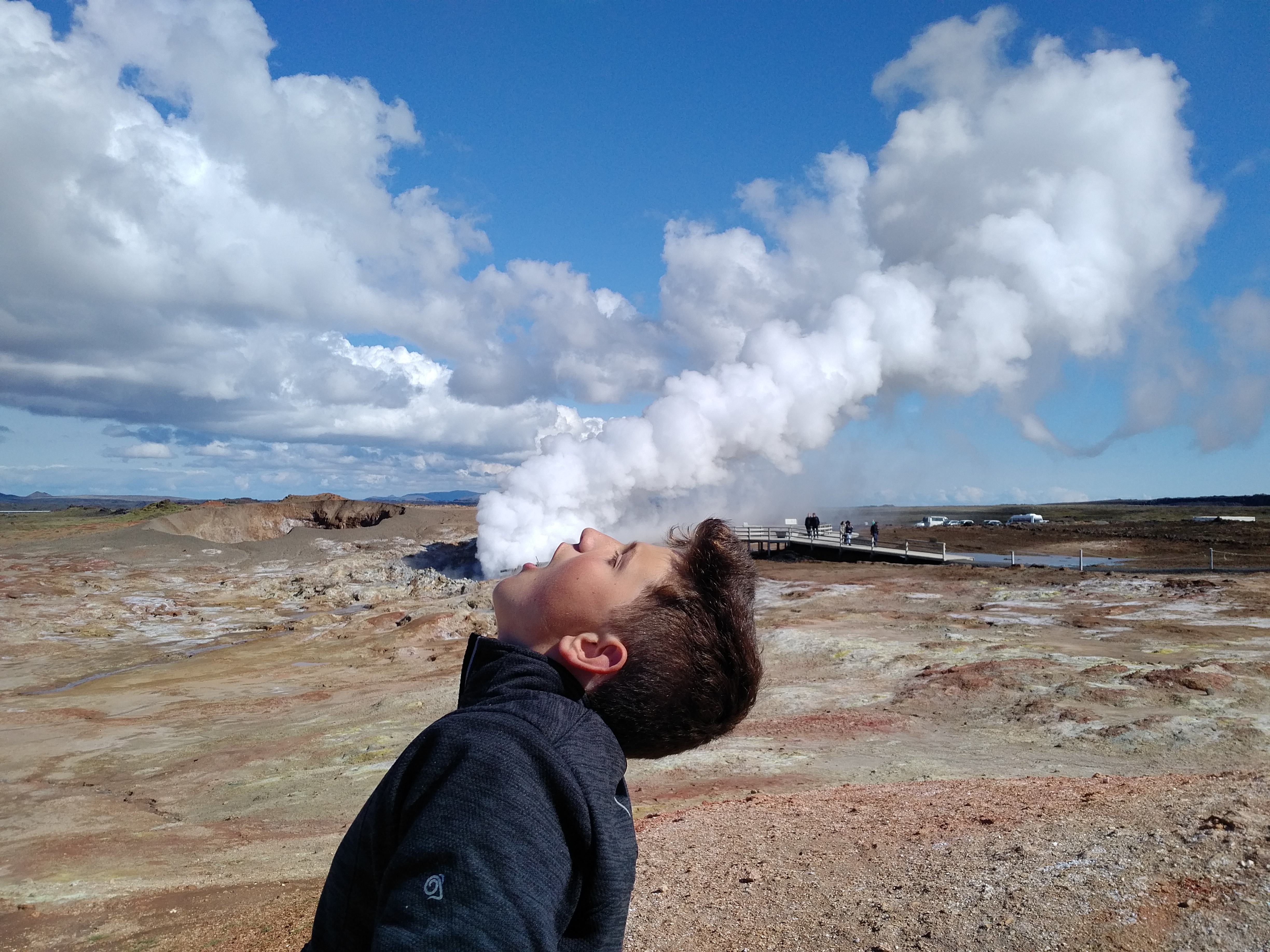
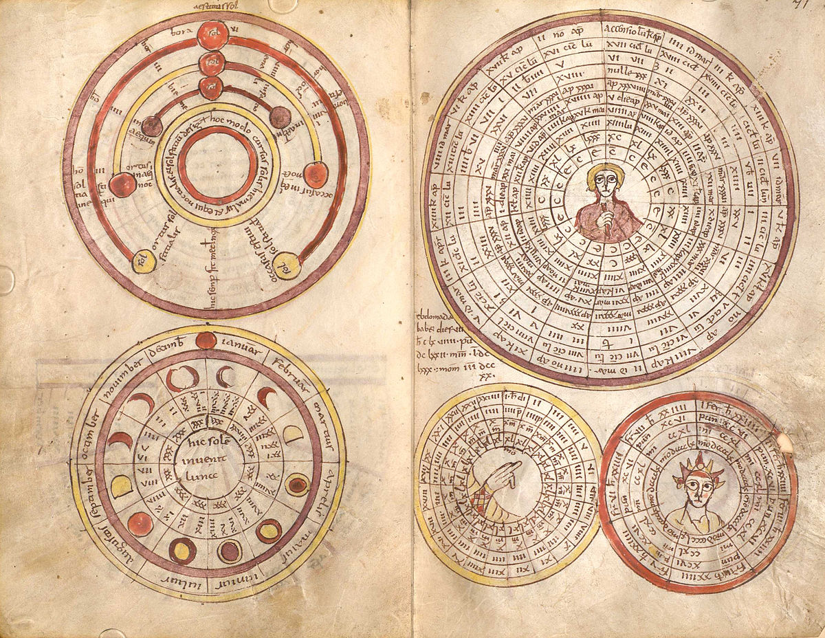
The Spring Equinox is the time of balance between light and darkness, heralding the promise of warmer weather and longer days. The daily rhythm of the rising and setting Sun is one that we cannot fail to notice; even in our electrically powered world we are aware that the Sun, Moon and Earth are somehow bound together in orbital cycles that give rise to day and night, the seasons, and the waxing and waning of the full and dark Moon. But these intricate relationships also give rise to some less well understood phenomena, including solar eclipses and lunar standstills, and there is plenty of evidence from Neolithic stone circles that are ancestors knew about them. Therefore, when I heard that a solar eclipse at the Equinox would have 98% coverage on the Isle of Lewis, location of the famous Callanish stone circles, I jumped at the opportunity to find out more.

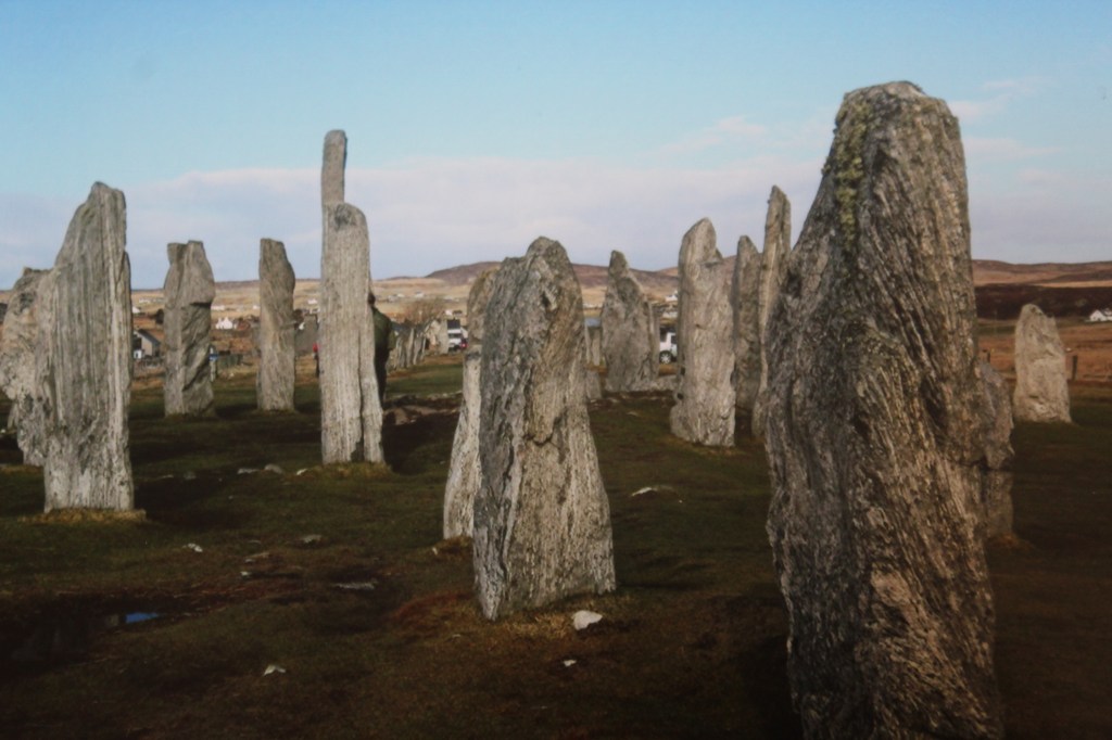
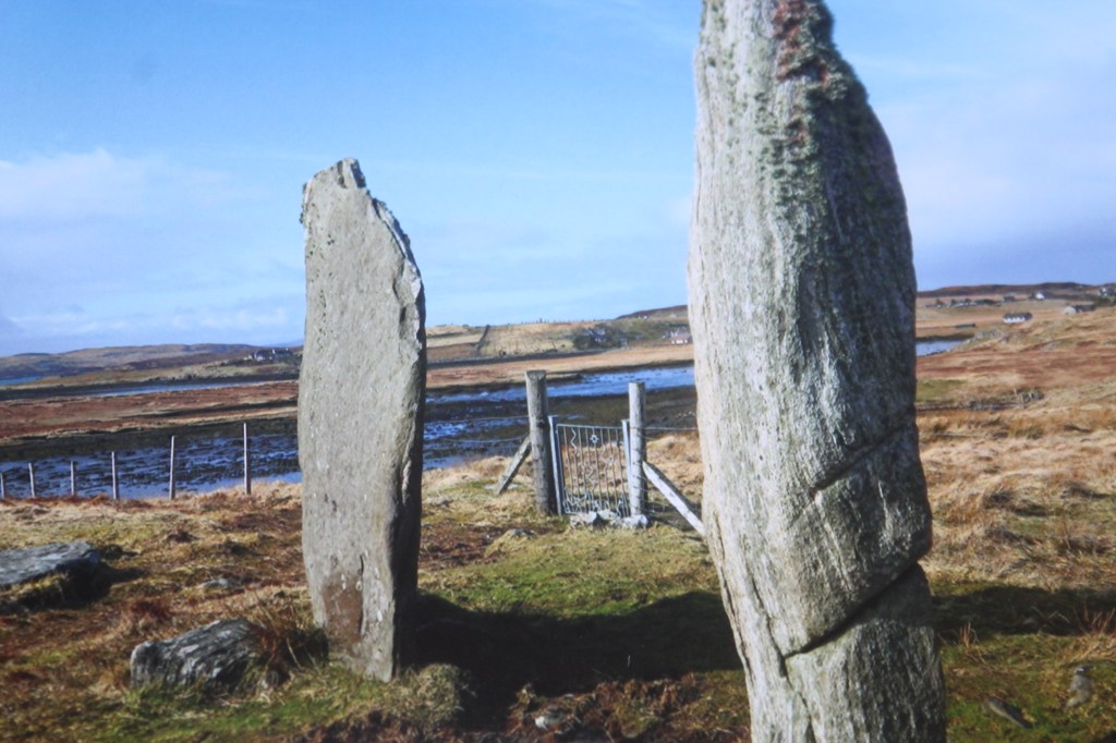
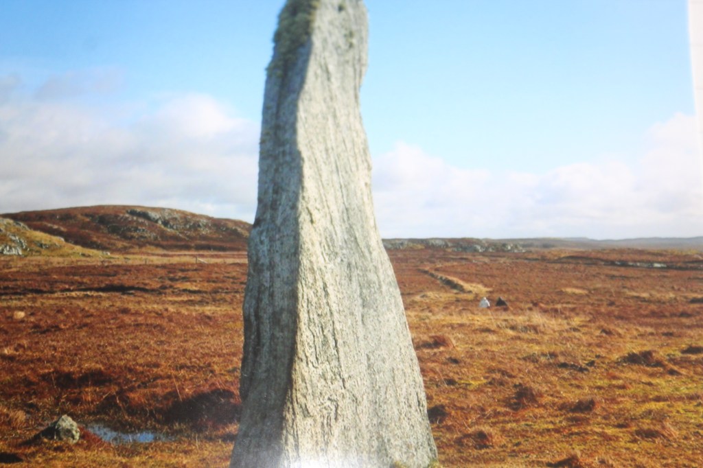
The main site at Callanish was built between 2900 and 2600 BCE and is centred round a circle of 13 gneiss stones, from which radiate four avenues towards the cardinal points, roughly in the shape of a Celtic cross. Alexander Thom mapped the site in detail and suggested that the southern stone avenue points to where the midsummer full Moon sets behind the Clisham Hills. [1] There are also theories that the large monolith in the centre of the circle lines up with the avenues to create an accurate north-south meridian, or pole, around which the stars appear to revolve. Given its position in the far north and the availability of some of the most beautiful (and ancient) rocks on the planet, the Lewisian gneiss, it is no wonder that this site is one of the foremost in prehistory.

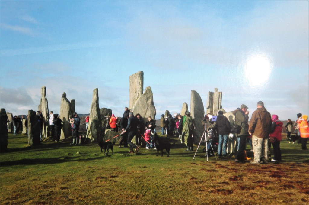
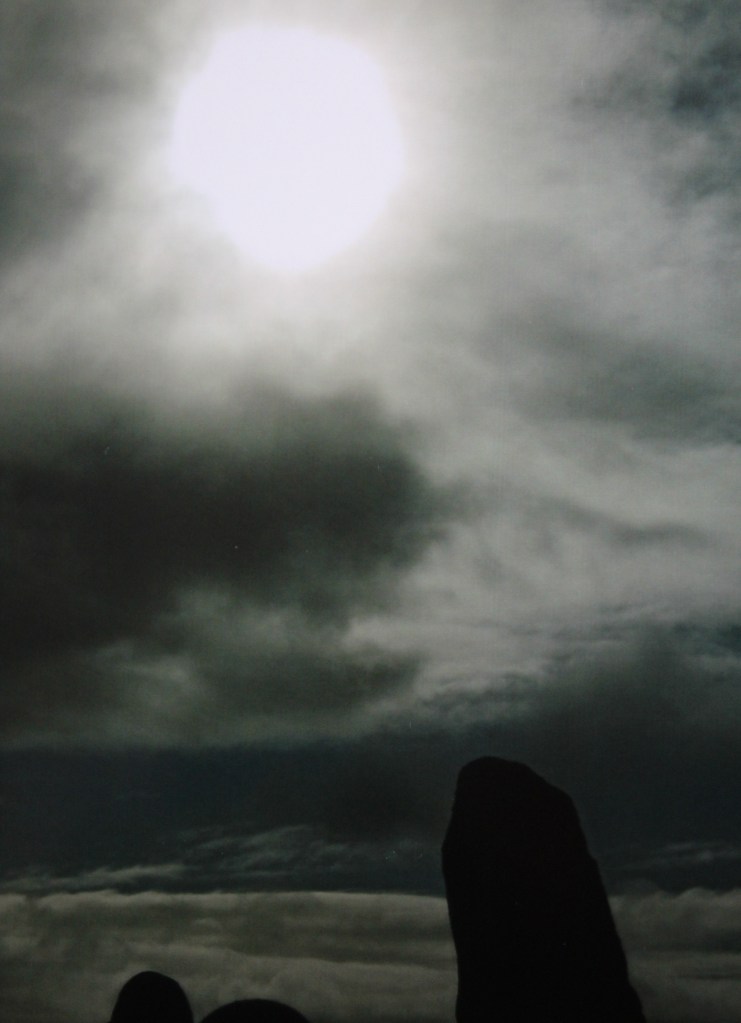
I joined the other throngs of people at the Stones early on the morning of the Equinox and watched with baited breath as the clouds thinned and patches of blue sky became visible. We were in luck! Though thick cloud cover would have prevented us from seeing anything, intermittent clouds could even enhance the effect of the eclipse through the interplay of the light and the shadow.

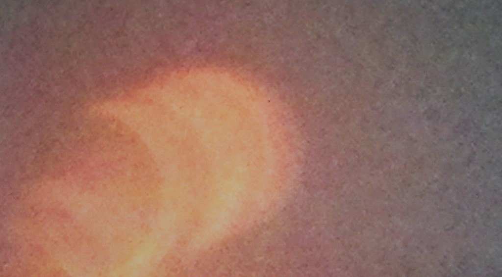
It was amazing to see one of Nature’s most admired, and feared, phenomena over Callanish. At the Equinox, the light and the shadow provided by the Sun’s orbital journey are in balance and during a solar eclipse a complementary relationship between the Sun and the Moon is at play. Though the Sun is 400 times larger than the Moon, it also happens to be 400 times further away. So, when the Moon’s orbit comes passes in front of the Sun, it has the effect of blocking out the light for a short period of time, it is eclipsed. The coverage here was not quite total, but nevertheless, the light of the Sun was eclipsed for long enough to witness overshadowing and some interesting light effects. I knew that Callanish was used to observe cycles of the Moon, but had it also been used as an eclipse predicter? I wanted to know about the relationship between the Sun and the Moon so I sought out resident Callanish expert and researcher, Margaret Curtis, to find out more.

Generally speaking, the cycles of the Moon as viewed from Earth are the opposite to those of the Sun. In the midwinter, when the Sun is at its lowest and weakest, the full Moon is at its highest and  brightest. Then at midsummer, with the Sun at its zenith, the Moon is at its weakest. However, over a period of around 19 years, the position of the full Moon around the solstices appears to oscillate and this is due to something called the Moon’s declination. The Moon’s orbit is not in the plane of the Earth’s Equator but inclined to it by approximately 5 degrees.  Additionally, as the Earth is inclined at 23.4 degrees to the plane of the Ecliptic (i.e. its tilt angle), this means that the Moon can change altitude in the sky ranging from 28.5 degrees (5.1 + 23.4) and 18.5 degrees (23.4 – 5.1). When at its greatest altitude, the full Moon will rise at its most northerly position in relation to the horizon, appear to hover, then retrace its steps. Two weeks later it will set at its most southerly extreme. Though lunar standstill happen to a degree every lunar cycle, a major lunar standstill (and the opposite, a minor lunar standstill) occcurs only once every 18.6 years, the timespan of the Moon’s precessional orbit.

Alexander Thom first coined the term ‘lunar standstill’ in 1971 after studying the alignments of many Neolithic stone circles in NW Europe, but in particular Callanish. He put forward evidence that Neolithic stone circle builders were not only aware of this phenomenon but used alignments between strategically placed stones and objects on the horizon to map and calculate them. Though his work is widely debated, researchers Ron and Margaret Curtis have continued over many years to investigate the alignments at Callanish.[2] During the most southerly stage of the major lunar standstill, the Moon when seen from the viewpoint of the Stones, rises over a range of hills known as the Old Woman of the Moors (bearing a resemblance to a reclined pregnant woman), skims the horizon and appears to touch the tips of certain stones, before setting, then magically reappearing between strategically placed stones in the central circle. The Moon appears very large and close during this time, and the effect is entirely magical (there are some good videos on U-tube).

Could an understanding of the geodesic relationships between lunar standstills and solstices be used to map and predict lunar and solar eclipses? It could be. In some ways, the standstills are polar opposites to eclipses, but both are linked through the Moon’s nodal cycle. Twice a year, the Moon will cross the Ecliptic, the path taken by the Sun across the sky. When it crosses in front of the Sun, a solar eclipse will happen. During eclipses the Moon is right on the nodes, at standstills, the Moon is at right angles to them.[3] As the builders of Callanish had an understanding of the 18.6 Metonic cycle as referenced in the lunar standstill alignments, could they also have applied this to predict eclipses? This area is certainly worthy of future research.

In March 2014, the Sun and Moon were aligned both to each other, and to the Celestial Equator and the Ecliptic, giving rise to an Equinox solar eclipse. It is fascinating to consider that as the Moon continued on its descending orbital path after this event, it would reach minimum declination over the autumn Equinox (2015), resulting in a minor lunar standstill the following year. Though we can begin to understand these events through science, the full magic of them only comes to life when we experience them. Something our ancestors did over the course of many thousands of years at places like Callanish.


[1] http://www.ancient-wisdom.com

[2] Ron and Margaret Curtis ‘Callanish: Stones, Moon and Sacred Landscape’

[3] ‘The Lunar Standstill Season’ by Jean Elliott at http://www.skyscript.co.uk

The Azores: fire and water


Located in the middle of the Southern Atlantic Ocean, the seven islands that comprise the Azores are a natural haven reminiscent of a bygone era. When we arrived Ponta Delgada it was a beautiful mellow evening in August, surprisingly temperate given the location, and we were struck by the laid back feel of the people, the vivid azure of the ocean and the skies that bathed the coastline in a beautiful ozone rich light. All of a sudden, the wind seemed to blow up from nowhere and the abrupt arrival of a storm swept in curtains of thick grey cloud laden with rain.   Now driving to our accommodation in the midst of a downpour, I pondered how this island climate is dictated by two large ocean-atmosphere teleconnections that oscillate over the Atlantic Ocean and influence weather well beyond the Azores.

As moist air rises over the tropics, it then sinks back down over the subtropical latitudes bringing high pressure and dry air. This region of high pressure is usually located close to the Azores and is therefore known as the Azores High. This is coupled with the Icelandic Low situated at the other end of the North Atlantic, where cold wet air rises over Iceland. Together these two atmospheric weather systems are known as the North Atlantic Oscillation (NAO) and govern the direction of the westerly winds and storms across the Atlantic. When the NAO is positive, the high and low weather systems are more intense than usual resulting in stronger westerlies, eastward driven Atlantic storms, wet conditions to Northern Europe and warmer conditions to West Africa. When the NAO index is negative, the pressure systems are less intense with less influence over Europe, less rainfall and lower temperatures. At present time of writing, the NOA index is in a positive phase.

In addition to climate, the geology of the islands is also unique by virtue of their location. Situated right on the Mid-Atlantic spreading ridge, basaltic magma wells up permanently from the depths in a maelstrom of activity forming massive underwater mountains of which the Azores is one. Black chunky rocks to the west of the island bear witness to this relentless activity, and it is a wonderful experience to watch the sun set over the vast expanse of Atlantic swell and hear the hiss and boom of the massive waves pummelling the basalt.

Driving round the island is easy, the roads good and the people and villages laid back and sleepy. But Sao Miguel embodies a secret beneath this calm and laid-back exterior. Out at sea, the mighty African, Eurasian and North American plates meet to form a T shaped junction called the Terceira Rift. The force of this zig zags through the island, twisting and tugging with huge and relentless force as these vast tectonic plates meet and rift apart.  I could sense the interplay of these undercurrents as we travelled round, nothing tangible just a sense of tension. Furthermore, it struck me that the Azores are located mid-way between the African and American continents and bear these influences in terms of culture, climate and weather conditions, another aspect that makes them so fascinating.

As you would expect with all this relentless Earth activity, the islands are also subject to volcanic eruptions and earthquakes, though not nearly as violent as those of Iceland at the other end of the Atlantic Ocean. Today the topography of the island is dominated by the remains of three stratovolcanoes that erupted to form calderas now filled with lakes. There is a spectacular crater rim walk round the Sete Cicadas volcano to the west of the island and you can drive along a ridge with spectacular drops on either side, though sadly we tried twice to do this and were thwarted each time by thick grey cloud. At the fire lake Lagos do Fogo in the middle of the island, you can watch clouds get sucked in and out of the crater by a combination of winds and pressure differences, and bathe beneath a waterfall made warm by the mild volcanic activity.

My favourite however was Furnas lake. We stayed in the delightful boat house here and could cycle round to the bubbling fumeroles and sulphurous mud pools where people come to cook food. In Furnas village itself, hot springs and healing waters have been used for centuries for therapy and bathing. Warm and nutrient rich, these waters also host a multitude of unique bacteria that give rise to a stunning natural array of colour and chemistry. At the Furnas Monitoring and Research Centre they are studying these bacteria, seeing how they give us insights into the beginnings of life on Earth and exploring potential uses for them.

Of all it’s many gifts, one of the most special is the nutrient rich waters that upwell round the islands attracting and nourishing a host of marine life including massive dolphin pods and migrating whales on their way to the Poles. Now a major source of revenue for the tourist industry, these magnificent creatures are now protected and fin whales, sperm, humpbacks and sei whales can be seen in large numbers all over the Azores. Curious, these creatures come close to tourist boats amazing and delighting us when once we just saw them as a source of blubber and oil. Swimming with dolphins one late afternoon was one of the most amazing experiences of my life. The waters were rough and grey, our boat bounced all over the waves and the threat of a coming storm also ensured that we were alone. Being surrounded in the sea by hundreds of dolphins, mothers, babies, some swimming, some jumping was a huge privilege, but I also felt the imprint of the trauma and blood that must have once coloured these azure waters a deep crimson.

Aphrodite: love, Cyprus and copper

On Valentine’s Day our thoughts turn to love, mainly of a sexual nature, and to beauty and pleasure. We have been bombarded with an array of pink paraphanalia, chocolates, roses and red love hearts, tempting us to buy and demonstrate the depth our feelings. What this has to do with St Valentine, a third century martyr and a pries, I do not know, but way before him this week in February was linked with the greatest of all goddesses, Aphrodite, the goddess of love, of erotic pleasure and beauty. And in turn, Aphrodite has long been associated with the island of Cyprus, with copper and a unique geological feature called an ophiolite.

According to Hesiod, Aphrodite was born of the sea, birthed from white foam that floated on the waves. She came forth fully formed and stepped onto land in Cyprus when all beneath her feet ‘blossomed and came into bloom.’ The foam, however, wasn’t just any old foam, but the products of the genetalia of her dismembered father (Uranus), chopped off by his son Chronus after the union of heaven and earth ended in tragedy. According to the myth, ‘Heaven came bringing on night and longing for love and he lay about Earth spreading himself full upon her.’ Their coupling was messy and chaotic, and by putting an end to it, Chronus (time) was seen to bring order to chaos. And Aphrodite, though born of this heavenly chaos, was also associated with a more complex approach to procreation, one that included joy, desire, pleasure and love. [1]

As her birthplace and main cult centre for her worship, Cyprus has been intimately linked to Aphrodite since at least the 12th century BC. However, archaeological evidence for her worship as goddess of pleasure, joy and life can be traced back to thousands of years earlier, when copper was first mined on the island. We have an abundance of evidence, [2] mainly associated with the chalcolithic cultures of Old Europe, to know something of the beliefs of these early Neolithic societies. Their primary deity was the creatrix, the birth giver whose creation was seen in the seasonal cycles of nature, in the miracle of birth and cyclic destruction, in the regeneration of life and in the abundance of nature from which all life originated and returned. Copper, as a gift of the Earth was considered to be of her body, a sacred part of creatrix, gifted to humans to work with. It was the smith, or metallurgist who knew how to extract the metal from the ore and create from it something useful, and he was thus considered to be a worker of sacred magic. On Cyprus, it was Aphrodite who became associated with the life affirming creatrix, and her husband Hephaestus, the smith who knew how to work with her gifts. And the reason for this – the presence of a copper bearing ophiolite.

But what is an ophiolite and how is it formed? About 80 million years ago, an ancient ocean named the Tethys Ocean began to close, forming the Mediterranean Sea and pushing up a piece of crust that came to be known as Cyprus. As the Tethys ocean disappeared and the dense ocean crust was pulled down at a destructive plate margin, something unusual occurred: a sliver of this oceanic lithosphere was pushed up and preserved in a terrane now called the Troodos Terrane. So the Troodos mountains are actually an ophiolite, or preserved piece of oceanic crust. Hydrothermal activity on the ocean floor typically result in the formation of sulphide deposits and in the case of the Troodos mountains, these sulphides were very rich in zinc, gold – and copper.

The cultic centres of Aphrodite at Paphos, Kition and Amathus are all linked originally to copper mining. Indeed we are told by Pliny the elder that it was king Kinyras who established her most famous sanctuary at Paphos also built the first copper mines and invented metallurgy, though both were clearly in existence way before him. [3]

Intriguingly Aphrodite was originally worshipped at Paphos in the shape of a sacred stone, or betyl. Today the sacred stone that stands in the sanctuary is a dark gabbro, a piece of the type of oceanic crust found in the Troodos ophiolite. This practice of worshipping sacred stones, either of meteoric or other geologically significant origin, is very ancient and prevalent over the Mediterranean and the Middle East. The stone would have been venerated and offered libations in the form of milk, honey, olive oil or wine, all products of Nature’s bounty. At Amathus, the second of her major sanctuaries, a slab carved with small round cavities was found in the oldest part, most probably used for libations of oil, honey, wine, salt, showing that this very ancient practice was still carried out at this date.

Throughout the Bronze Age as our relationship with nature started to change, we see a change in the way that Aphrodite was worshipped. The third great temple on the island was at Kition near Larnaca. This city was founded by the Phoenicians, the great merchants of the Bronze Age. They brought with them the worship of the love and fertility goddess Ishtar or Astarte, in turn descended from the much older Sumerian Inanna. All became blended into one, with shared characteristics but different names and the goddess started to change from a creatrix embodying the cyles of life with all its abundance, into the anthromorphic form of a beautiful (but flawed) woman. And with this split came a split in our relationship with love and pleasure with which the goddess was so firmly associated. One aspect of Aphrodite was said to be called Ourania, or heavenly, and the other Aphrodite, Pandemos, or common to all people.

As described earlier, in her original form, Aphrodite was associated with the creation of the universe, the product of the union between the mating of heaven and earth itself (Ourania). Later she became the unfaithful wife of Hephaestus, now depicted as wounded and vengeful, snared in a net by him whilst coupling with none other than Ares, the god of war (Pandemos).

Aphrodite and her myths clearly embody this split between higher and lower love, between love of the universal heart (agape) and love of the human heart. What is more surprising is that the island of Cyprus itself seems to embody this schism. Since 1972 the island has been divided between north and south, with checkpoints and barbed wire separating the two halves. The two ancient civilisations who gave so much to humanity, the Greeks and the Turks, are now energetically holding these aspects. Perhaps the origin of this schism stems back to the Trojan war, when the Greeks and the Trojans fought from the place of the lower self and ownership of a woman, Helen of Troy. Maybe we have focussed so long on our personal hearts and dramas (Pandemos), that we have forgotten our connection to the universal heart and heavenly love (Ourania). So, this ‘Valentine’s day’ is a great opportunity to re-integrate them both and really make it Aphrodite’s day, in her healed and whole aspect.  


[1]‘ Kypris, the Aphrodite of Cyprus’ by Jacqueline Karageorghis

[2] ‘The Goddesses and Gods of Old Europe’ by Marija Gimbutas

‘[3] Kypris, the Aphrodite of Cyprus’ by Jacqueline Karageorghis

Iceland – Earth, Air, Fire, Water

Iceland is a magnificent example of the interplay of the four elements, and how simple principles such as hot air rising and cold sinking combine to produce a breathtaking array of nature environments, and the habitats to support complex and rare life forms. Its geology is unique in the world; nowhere else do you get a mid ocean ridge, by definition usually on the ocean floor, and a hot spot (or mantle plume) in the same place, and it is also where the Eurasian and American plates meet and are pulling apart at the same rate as finger nails growing. These two features alone are very exciting as they enable us to study at first hand, without getting too remote or wet, mechanisms that could have operated early in planetary formation.

The formation of oceanic crust is the most basic and proliferate process on Earth. Magma wells up from the mantle at constructive plate boundaries and solidifies to form the ocean floor, pushing up large underwater mountains in the process. In Iceland a ridge of this sort rises about 3000 m above the floor, emerging in the Reykanes peninsula in the tip of southwest Iceland, quite close to Keflavík airport, and zig zags across the country forming a rift zone, before plunging deep into the Arctic Ocean in the north. On this peninsula it is therefore possible to ‘hold up a trans-continental bridge’ and its almost ferocious geological activity enable us to ‘blow hot sulphurous air.’

Another famous place to see the spreading ridge at close hand is in Thengvellir National Park, easily accessible as part of Iceland’s Golden Circle. It is also the site of Iceland’s first parliament, the Alping, probably one of the oldest parliament’s in the world. And all of this on a spreading ridge between two continents.

Though basalt is a very common rock type, the varieties in which it can manifest are what gives Iceland its awesome beauty. From blocky lava fields resembling lunar landscapes, infertile and barren, olivine tholeiites have been squeezed up from the upper mantle by decompression melting. Sometimes more regulated, the basalt forms orderly layers resembling a chocolate and coffee cake, stretching for miles along ancient eruption fissures.  Infertile lava and ash deserts crunch underfoot like glass, turning easily to dust, but when water is present, tiny white flowers grow in proliferation, carpeting the basalt. Gently undulating volcano slopes covered in mossy green fuzz, sometimes hues of purple, roll for miles, perfect cones loom up from rubble landscapes and others are more craggy, bearing witness to more powerful and inconsistent forms of erosion. At Myvatn, pseudocraters have been formed as a result of lava flowing over damp ground and causing it to bubble up and form cone shapes, and nearby mud pools have been formed from solidified clay.

Along the south coast, weathering and erosion has formed spectacular black sand beaches as far as the eye can see. At Vik, surely Iceland’s most beautiful beach, basalt has organised itself into its most spectacular form, that of hexagonal basalt columns, glistening like black organic pipes covered in exuberant frothy foam from the crashing Atlantic waves, and there are also rugged sea stacks just off shore to admire, one of nature’s sculpture. In the cliffs about the basalt, puffin colonies nest wheeling busily overhead as they fly out on stormy air currents above the turbulent waves. In the western fjords, it is also possible (though rare) to spot a sea eagle, and gyrfalcons can also be seen in the more mountainous areas.

Water is abundant in all of its myriad forms. Milky rivers cut their way through slate grey canyons as warmer temperatures in the summer cause water locked up in snow and ice to melt. Sometimes it forms small streams and trickles over boulders, other times wide frothing rivers gushing urgently downhill, pouring over basalt ledges and crashing into larger rocks so that it leaps in a haze of spray. Occasionally it can also be seen tumbling over volcanic cliffs in a frothy cloud, or else a tiny silver trickle. But at both Dettifoss in the north and Gulfoss in the south, water turns into a furious torrent and erupts over ledges to form the the largest waterfalls in Europe in terms of both volume and height. These spectacular displays of the power leave one exhilarated, awestruck, and drenched. But it is surely water in its solid form that it the most breath takingly beautiful.

Though many of Iceland’s glaciers have receded during the Holocene interstadial, it still has two large ones. At Longjokul in the West it is possible to go inside a glacier and admire at the different hues of blues on display from cerilian to azure, all directly from natures palette, due ot the air being squeezed out from between the ice crystals by the weight of thousands of tons of ice overhead. On the south of the island another marvel awaits, the sight of icebergs calving. As a glacier becomes unstable, usually because of a warming climate, they discharge small icebergs that make their way to the ocean and melt. The site is one of nature’s most majestic, as huge blocks of ice tinted ozone-blue float on a liquid (one of the many unique properties of water) carrying trillions of dust particles that bear witness to thousands of years of accumulated rainfall.

Whilst fire and earth give Iceland its unique geological features, it is the interplay of air and water that creates the environment for its wildlife. Iceland is located at the boundary between the cold dense water of the Arctic comes down from the North, and the warmer Atlantic water masses that come up from the south, including the Gulf Stream. Where warm meets cold a front is created and nutrient and oxygen rich waters are brought up from the depths, made buoyant because of differences in cold salty ocean masses and lighter warmer water bodies. This polar front is also located at the boundary between two giant atmospheric circulation cells that distribute heat and water from the tropics to the poles through the principle of convection.  The so-called Ferrell cell is influenced by the warm south westerlies that blow up from the tropics causing warm moist air to rise at 60 degrees north where Iceland is and then descend as cold dry air at around 30 degrees north where another atmospheric circulation cell. This is the Hadley cell and it is powered by the interplay of ocean and wind at the Equator, and the Polar cell by this same cold interplay at the poles. Squeezed between the two, the Ferrell cell near Iceland is dependent on the other two cells for its power, so it is no surprise that Iceland is (inversely) linked to European climate. Last year, 2018, when Western Europe had one of the hottest spring and summer’s on record, it rained every day in Iceland.

Though inconvenient for us when trying to enjoy the outdoors, for animals and birds this mingling of cold and warm, of dense and fresh, of upwelling and downwelling is the very source of life. Nutrient and oxygen rich waters are brought up from the depths attracting krill and plankton, and in turn many different fish and whale species.  In the North, it is possible to see the occasion blue whale, sperm whale or orca, and fin, sai and minke and pilot whales in larger numbers. In the past, vast cod and herring shoals came into Icelandic waters but now due to both overfishing and the climate change affecting the positioning of ocean currents, the shoals re now located further north and smaller in number. For the same reasons, it was also once possible to see the majestic blue whale from the snafels peninsula, easily accessible form Reykjavík, but shifts in ocean currents have moved on this king of the ocean.

The Eyjafjorour fjord where Akureyri is located is also a great and comfortable place to see humpback whales who frequently come into the fjord from the Arctic due to the nutrient rich waters. It is also one of the few places on Earth where experienced divers can explore a hydrothermal vent, usually only found at ocean trenches deep in the ocean. Both of these natural and geological wonders are the result of a retreating glacier that once covered the area.

It wouldn’t be fitting to finish without making reference to Iceland’s volcanoes, large and numerous and by far the most active in Europe. Today harnessed as a source of hydrothermal power, the awesome energy of these volcanoes has influenced history for millennia. When Katla erupted in 1918, world history was made and its continuous outgassing makes it one of the largest volcano sources of CO2 on the planet. The eruption of Hekla in the Bronze Age (around 2345 BC)  could have been linked to climate change that resulted in the decline of many thriving Bronze Age civilisations,  and the 1159 BC event to plague, famine and pestilence during the reign of King David. [1] In more recent times, the sub glacial eruption of Eyfafjallojokull in 2010 grounded European flights for weeks because of fears of volcanic ash and the more recent rumblings of Grimsvotn, lurking beneath the largest glacier on Iceland, threatened to do the same. We are long overdue for the next major eruption, and there are four main candidates as to which one is next. Katla, Hekla, Grimsvotn or Bardarbunga? Nobody knows for sure which one, but at the time of writing (January 2019), a minor earthquake swarm on the Reykanes ridge could just be indicating deeper activity beneath Hekla. Nobody really knows which one, or when, but that it will happen is not in question. And when it does, it will be big.


[1] See ‘Exodus to Arthur’ by Mike Baille for more information

A January Vegetable Garden

The Winter Solstice has passed and the hopes of new growth in Spring are still a few weeks off.  At this time of the year we retreat and rest, taking advantage of the long dark nights and short days.  This is the same for your soil.

I’ve covered most of my soil over to keep in all the nutrients, minerals and lovely dark humus matter, it’s keeping it warm and protected from the elements (I don’t want the rain to leach them all out, my vegetables need them!).  When it gets warmer the soil will be ready, the days longer, so the planting can begin.  However, the brassica bed, which was continuing to produce lovely vegetables and leaves well into the winter, has been devoured.  A wet autumn made the chicken run a muddy mess so ‘The Doris’, (four rather large hens) were given free range in the vegetable garden.  The beetroot has been kicked round like footballs, kale, cabbage and chard have been eaten to within a millimetre of existence but the soil has been beautifully scrapped through and turned over.  The results are eggs with yellow yolks as bright as a beautiful mid-summer sun.  So all things considered, that’s not too bad a trade-off.

My plans for this years’ crops are being considered.  I use the phases of the Moon as a planting guide and as we enter the dark moon phase in January, I am reading my notes from last years’ growing diary, trying to work out what will grow best and what gave results I hadn’t quite expected last year?  Also, do I really want to grow that many courgettes this year?  Setting aside time during the waxing phase of the moon, I can work on my order for seeds, plugs and plants, then as the moon reaches its’ fullness on 21st January, I can visualise my lovely little vegetable garden, full of life, colour and food.  As the moon wanes, my thoughts turn to preparing the planting calendar, as I retreat once more in front of a cosy fire with a mug of fennel tea (yes, harvested from the garden) resting, ready for new growth. IMG_0175

September Heaven and Earth Calendar

1st International Day of Older Persons

2nd International Day of Non-Violence, Mahatma Gandi’s birthday

5th World Teacher’s Day, Waxing half moon (17.45)

7th World Habitat Day

9th World Post Day, Yom Kippur (Jewish)

10th World Mental Health Day

11th International Day of the Girl Child 

13th Full Moon in Aries (22.57)

14th Indigenous People’s Day, Sukkot begins (Jewish) 

16th World Food Day

17th International Day for the Eradication of Poverty

20th Birth of the Bab (Bahai’i)

21st Waning half moon (13.39), Orionids metor shower

22nd Simchat Torah (Jewish)

24th United Nations Day

27th Diwali (Hindu), BST ends

28th New Moon (3.38)

31st Halloween, Mercury retrograde